
Photogrammetry is the art, science, and technology of obtaining reliable information about physical objects and the environment through processes of recoding, measuring and interpreting photographic images and patterns of recorded radiant electromagnetic energy and other phenomena, as defined by ASPRS.
All aerial surveys and compilation are handled in house by skilled technicians and are preformed using a combination of DAT/EM’s Summit Evolution, Bentley’s MicroStation, and Autodesk’s AutoCAD environments. Using these photogrammetric and design workstations, Synergy Mapping can render accurate representations of terrestrial features and can tailor products to meet the needs of individual clients.

Digital Aerotriangulation is the first and most important step in geospatial processing. It is the process of assigning ground control values to points on a block of photographs by determining the relationship between the photographs and known ground control points. Synergy has a process with built in redundancies to safeguard the quality of the final solution. The software preferred to carry out this task is Trimble’s Inpho software suite, Trimble Inpho photogrammetry modules are designed to precisely transform raw classic aerial, UAS and satellite images using state-of-the-art photogrammetry techniques.
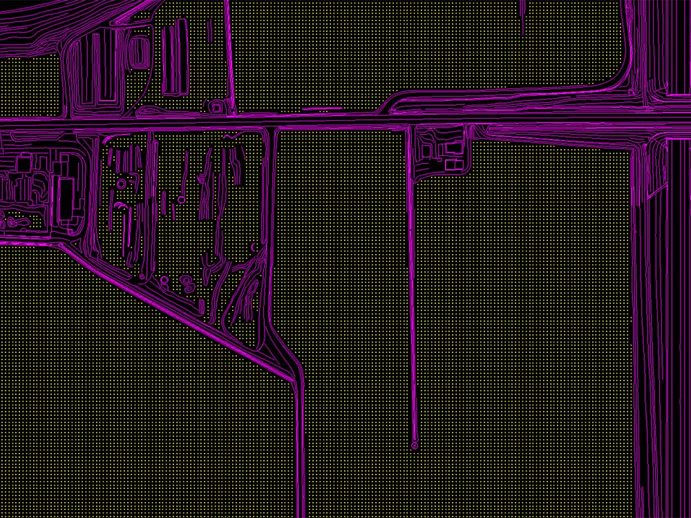
Planimetric Mapping is a technique showing only the horizontal position of features on the Earth's surface which show geographic objects, natural and cultural physical features, and entities without topographic features such as roads, buildings, and water bodies that are visible and identifiable on aerial photographs, but which can be compiled into map features through photogrammetric or surveying procedures. A planimetrically accurate map showing planimetric detail and other general features shows accurate horizontal distances between features.


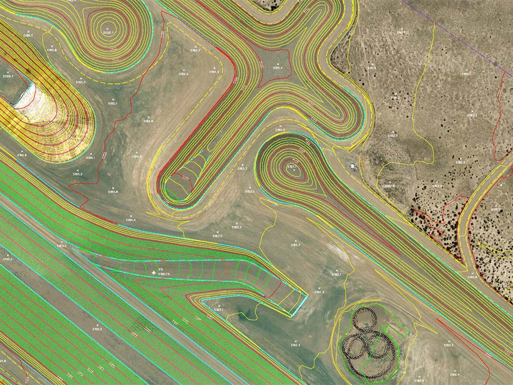
Topographic Mapping is a method which depicts terrain relief showing ground elevation, usually through contour lines and spot elevations. The map represents the horizontal and vertical positions of the features represented. It is a graphic representation delineating natural and man-made features of an area or region in a way that shows their relative positions and elevations.
Digital Terrain Model or DTM is an elevation surface representing the bare earth referenced to a common vertical datum and is the basis for all contouring. Synergy can achieve accurate bare earth calculations utilizing an assortment of tools which include breaklines, auto correlated grid points, and LiDAR mapping. Synergy employs these tactics within certain parameters to be more time and cost efficient, all the while, meeting and exceeding accuracy standards set by ASPRS and NMAS.

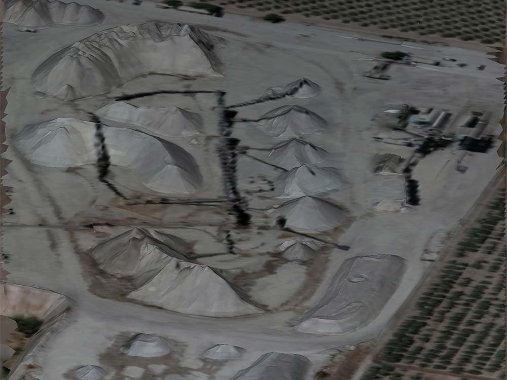
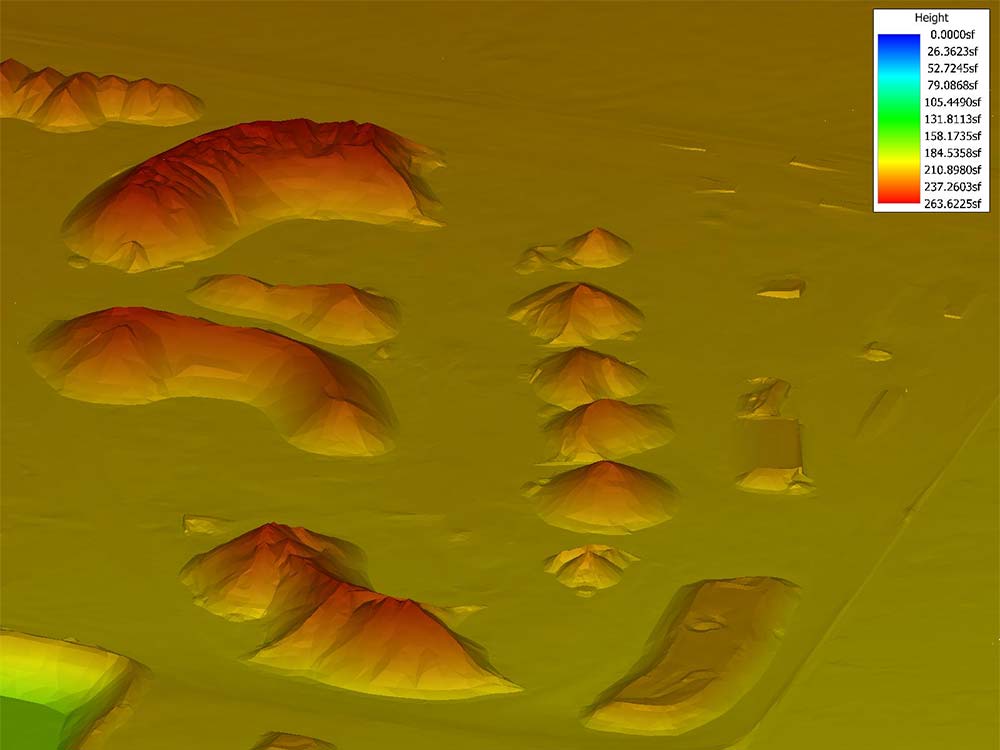
A stockpile is a pile or storage location for bulk materials, forming part of the bulk material handling process. Stockpiles are used in many different areas, such as in a port, refinery or manufacturing facility. We are able to accurately determine the amount of said material giving a reliable calculation for defined stockpiles.
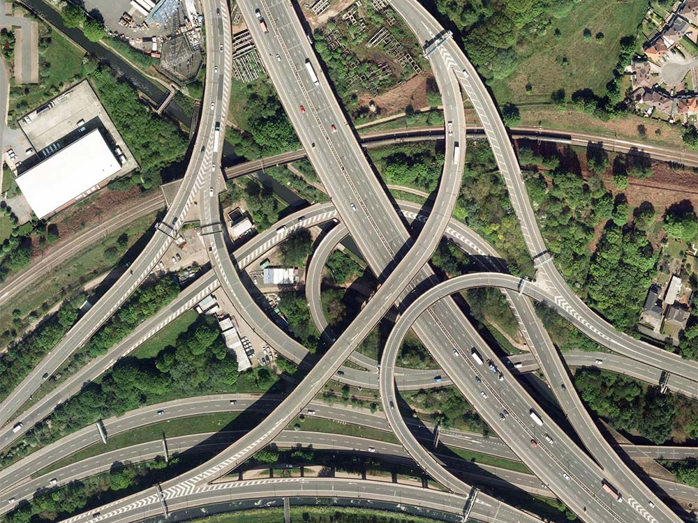
Digital Orthophotos are aerial photographs or images geometrically corrected ("orthorectified") such that the scale is uniform: the photo has the same lack of distortion as a map. Unlike an uncorrected aerial photograph, an orthophotograph can be used to measure true distances, because it is an accurate representation of the Earth's surface, having been adjusted for topographic relief, lens distortion, and camera tilt. Orthophotographs are commonly used in geographic information systems (GIS) as a "map accurate" background image.

