Digital Aerial Triangulation Services
Are you searching for “Digital Aerial Triangulation Services Near Me?”
Synergy Mapping, Inc. offers specialized Digital Aerial Triangulation services essential for high-precision aerial mapping projects across industries like construction, agriculture, and urban planning. Utilizing state-of-the-art technology and expert techniques in aerial triangulation and ground control, our services ensure accurate mapping and data analysis in Colorado, Nevada, California, and the United States. Contact us today to enhance your project’s accuracy and detail.
At Synergy Mapping, Inc., we are dedicated to excellence in digital aerial triangulation, providing precise and expansive aerial mapping solutions tailored to meet the specific requirements of diverse industries. Leveraging cutting-edge technology and a team of highly skilled professionals, we ensure that our digital aerial triangulation services enhance planning, implementation, and analysis across various sectors.

An Introduction to Synergy Mapping, Inc.
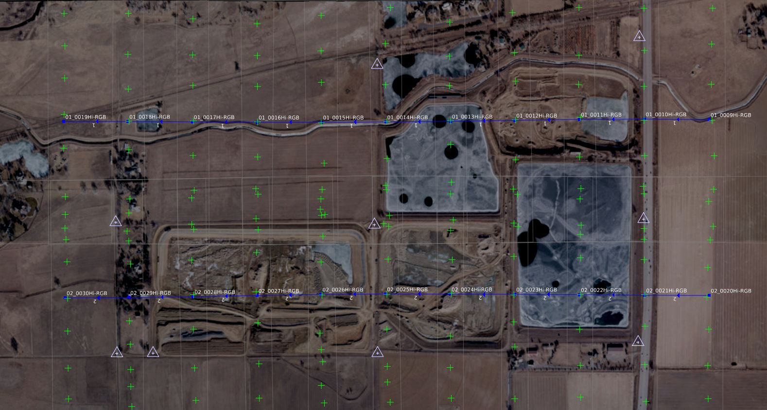
Welcome to Synergy Mapping, your expert in Digital Aerial Triangulation. This specialized service is critical for accurately determining the three-dimensional coordinates of points on photographs, providing essential data for various mapping and surveying projects. Serving a diverse range of industries, from construction to environmental monitoring, our aerial triangulation services facilitate precise project planning and execution by integrating high-quality aerial imagery with ground control points.
Maximize Project Accuracy with Precision Mapping
Unlock precision and detail in your next project with our Digital Aerial Triangulation services.
Contact Synergy Mapping, Inc. today to discuss how we can elevate your project’s accuracy to the next level.Our Digital Aerial Triangulation Services Across Various Industries
At Synergy Mapping, Inc., our digital aerial triangulation services are tailored to meet the unique demands of a wide array of industries. By employing sophisticated aerial mapping techniques and precise ground control points, we deliver essential data that enhances project accuracy, from initial planning to final execution. Here’s how our services benefit various sectors:
Construction
We provide detailed site data for planning and continuous monitoring of large-scale construction projects. This ensures that all phases of development adhere to precision requirements, helping to avoid costly errors and delays.
Architecture
Our services support precision agriculture by offering detailed mapping for crop planning, monitoring, and management. This aids farmers and agribusinesses in optimizing resource use, increasing yield, and improving overall farm management practices.
Forestry
In forestry, accurate mapping is crucial for sustainable management, conservation efforts, and effective resource allocation. Our aerial triangulation aids in detailed forest mapping, helping to manage and conserve forest resources more effectively.
Archaeology
We equip archaeologists with high-resolution site images, aiding in the non-intrusive exploration and preservation of historical artifacts and structures. This technology allows for a deeper understanding of archaeological sites without the need for disruptive excavation methods.
Disaster Management
Our digital aerial triangulation plays a pivotal role in disaster preparedness and response strategies. By providing accurate and up-to-date maps, we help organizations in risk assessment, resource allocation, and effective mitigation planning.
Mining and Quarries
In the mining and quarry industries, precision mapping is essential for safe and efficient operations. Our services support these industries by providing detailed surveys that ensure safety standards and operational efficiency are maintained.
Transportation and Infrastructure
We facilitate the development and maintenance of transportation networks by providing foundational data crucial for infrastructure projects. This ensures that new infrastructures integrate smoothly with existing networks, enhancing connectivity and functionality.
Urban Planning and Development
Our services aid urban developers in the meticulous planning and designing of new developments. By providing detailed and accurate urban maps, we help ensure that new projects complement and enhance existing urban landscapes.
Environmental Monitoring
We offer invaluable services for environmental studies, providing detailed imagery that tracks changes in ecosystems and assesses environmental impacts. This information is critical for environmental conservation and sustainability efforts.
Utilities and Telecom
Digital aerial triangulation supports the planning and ongoing maintenance of utility and telecommunications networks. Our accurate mapping assists in the layout and installation of utilities, helping to avoid conflicts and ensuring efficient service delivery.
Commercial Real Estate
Our mapping services enhance real estate development and marketing efforts by providing detailed property overviews. This is crucial for attracting investors and buyers by showcasing property potential and value accurately.
Oil and Gas
We deliver essential data for the oil and gas industry, supporting exploration and pipeline monitoring. This ensures operations are carried out safely and efficiently, with minimal environmental impact.
Solar Energy
Our detailed site analysis through aerial triangulation aids in the optimal placement and design of solar panels. This ensures maximum efficiency of solar installations, contributing to the effectiveness and viability of solar energy projects.
Wind Energy
We assist in the planning and maintenance of wind farms by providing precise location data for turbine placement. This optimizes the performance of wind turbines and ensures that energy production is maximized.
Transform Your Data into Decisions
Ready to transform your aerial data into actionable insights? Contact Synergy Mapping today to learn how our Digital Aerial Triangulation can directly benefit your specific industry needs.
Contact Synergy Mapping, Inc. now for expert guidance and support!Benefits of Using Synergy Mapping, Inc.
High Accuracy and Precision: By utilizing top-of-the-line aerial sensors and advanced processing algorithms, Synergy Mapping, Inc. delivers exceptionally accurate maps and data critical for precise measurements and analyses. Our commitment to high-resolution imaging ensures that every detail is captured, reducing errors and enhancing the quality of the final output.
Rapid Data Delivery: Leveraging our streamlined workflows and cutting-edge technology, we offer rapid turnaround times that are crucial for meeting tight project deadlines. Our efficient data processing techniques ensure that clients receive their deliverables promptly, helping to accelerate project timelines without sacrificing data quality.
Versatile Applications: Synergy Mapping’s services are versatile, supporting a broad spectrum of applications across various sectors including urban planning, construction, environmental management, and disaster response. Our expertise enables us to adapt our solutions to meet the unique demands of each project, making our services indispensable to clients from different industries.
Client-Focused Solutions: At Synergy Mapping, Inc., we prioritize understanding each client’s specific needs and project goals. Our approach involves close collaboration with clients to tailor our services accordingly, ensuring that every solution we provide is perfectly aligned with their project requirements and expectations.
Our Digital Aerial Triangulation Services
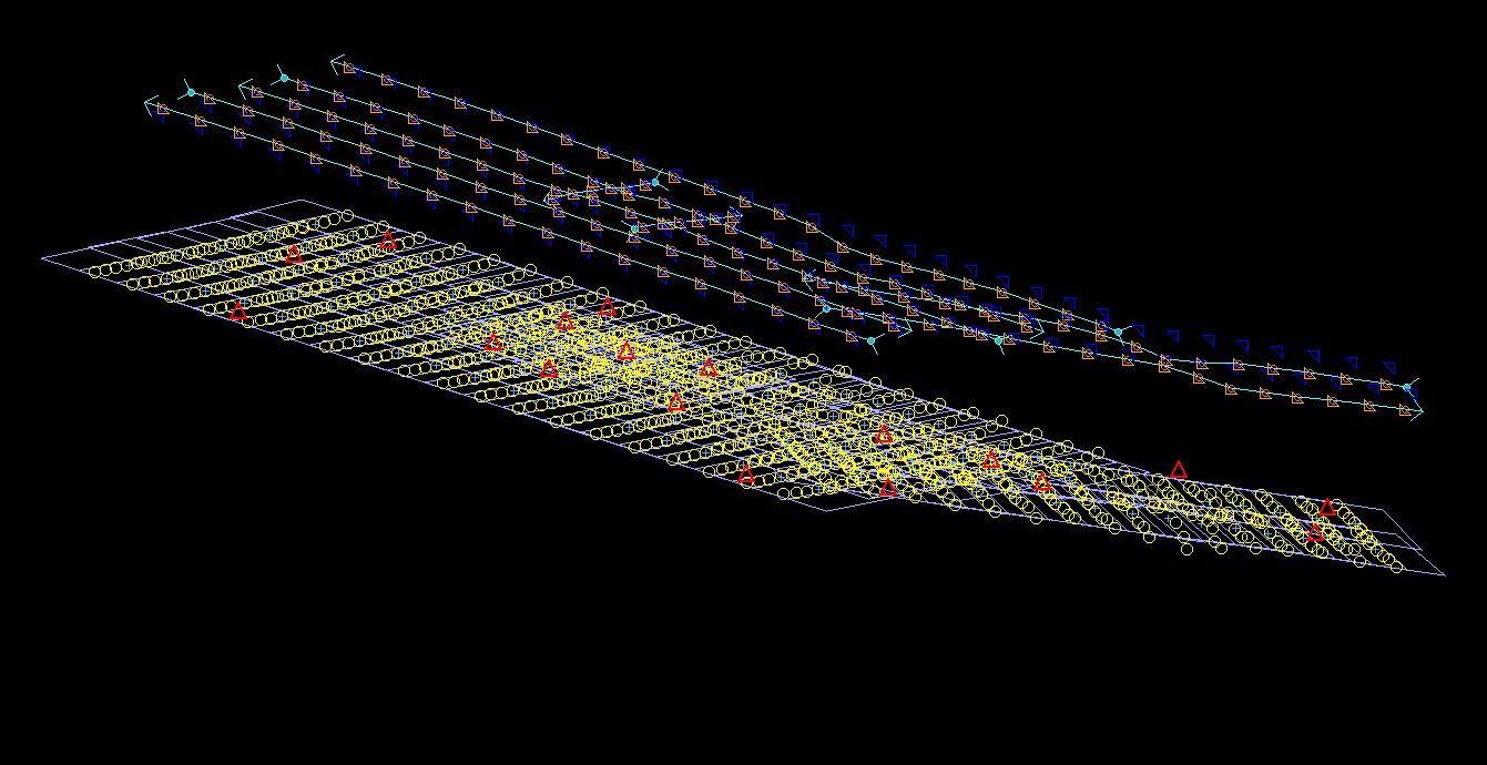
Aerial Mapping Services
Using precise aerial triangulation techniques, we produce detailed and accurate maps that are crucial for planning and decision-making across sectors such as mining, construction, and environmental science.
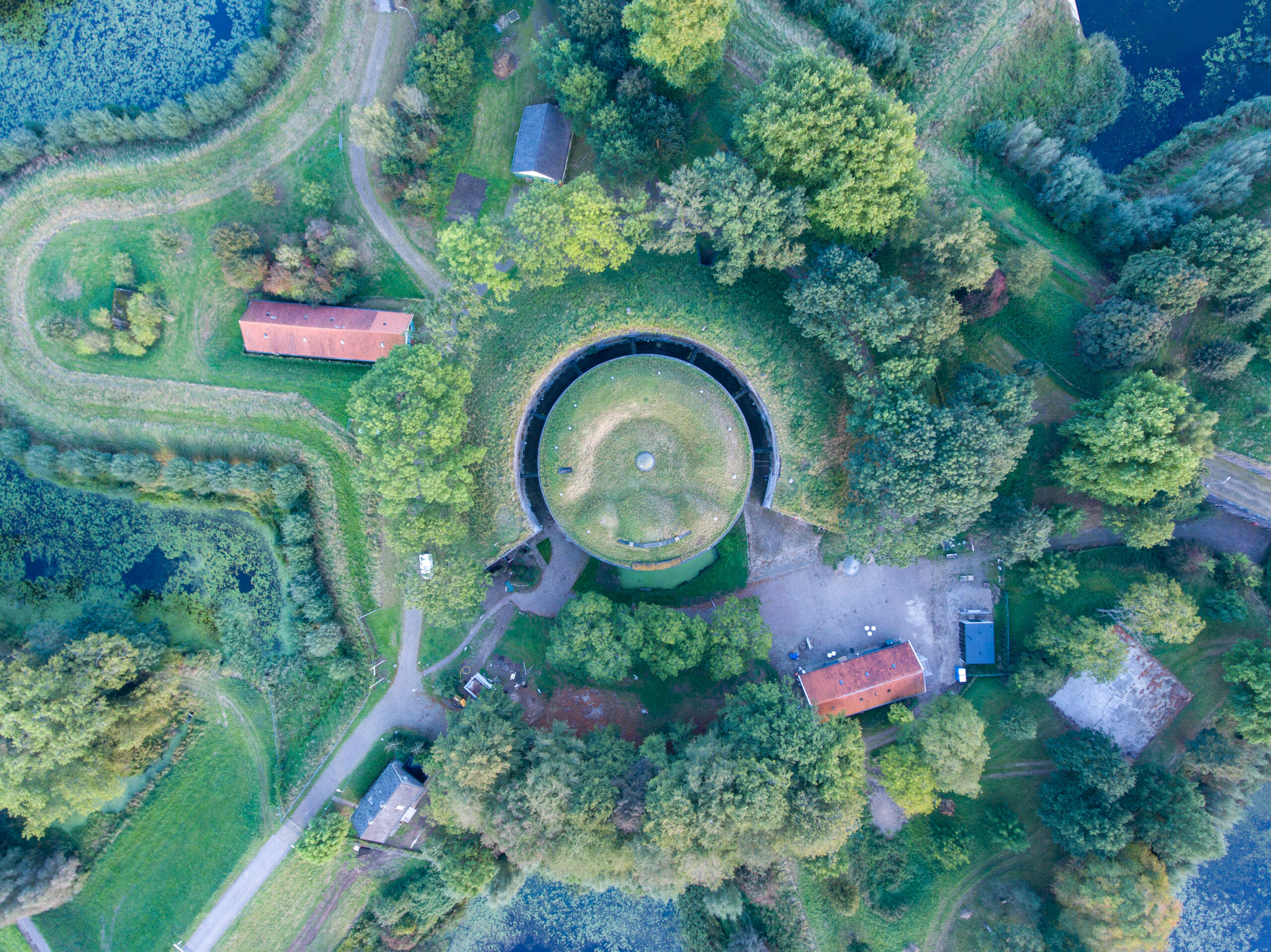
Aerial Survey Services
Our aerial surveys gather extensive data for large-scale land assessments, which is especially beneficial for industries such as agriculture and forestry, helping them to manage their resources more effectively.
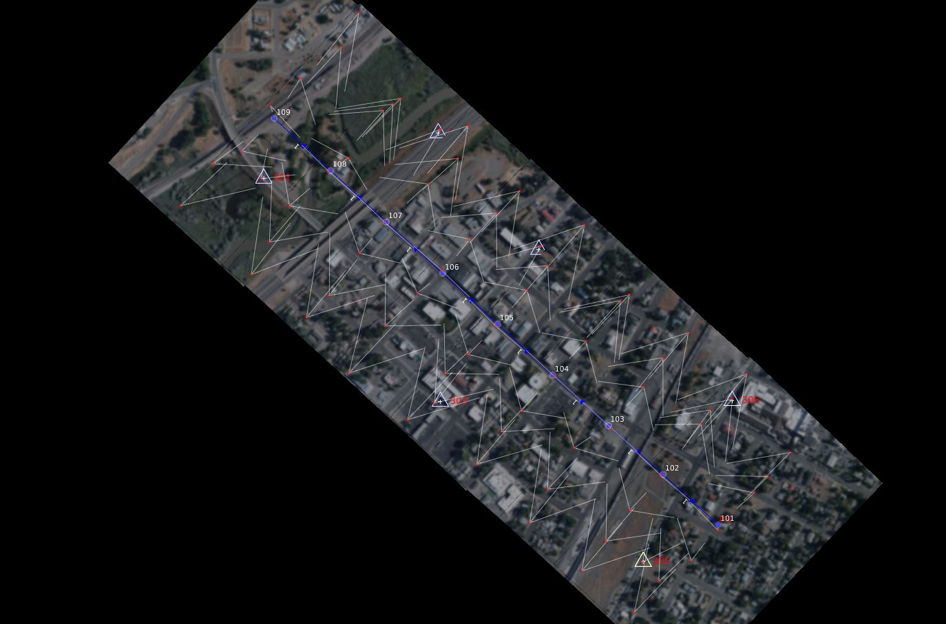
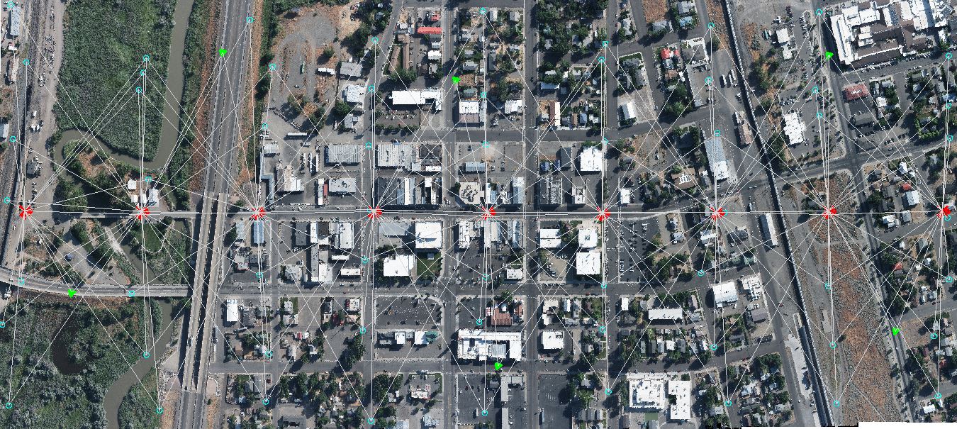
Aerial Imaging Services
We deliver high-quality, wide format aerial imaging suitable for a variety of applications, from documenting large-scale events to detailed environmental monitoring and orthophoto generation. Our services ensure you receive the most detailed and useful imagery available.

Ground Control Survey
To ensure the accuracy of aerial triangulation, we incorporate meticulous ground control surveys. This crucial step enhances the precision of the spatial data collected, forming the backbone of accurate aerial mapping.

Ground Control Points in Surveying
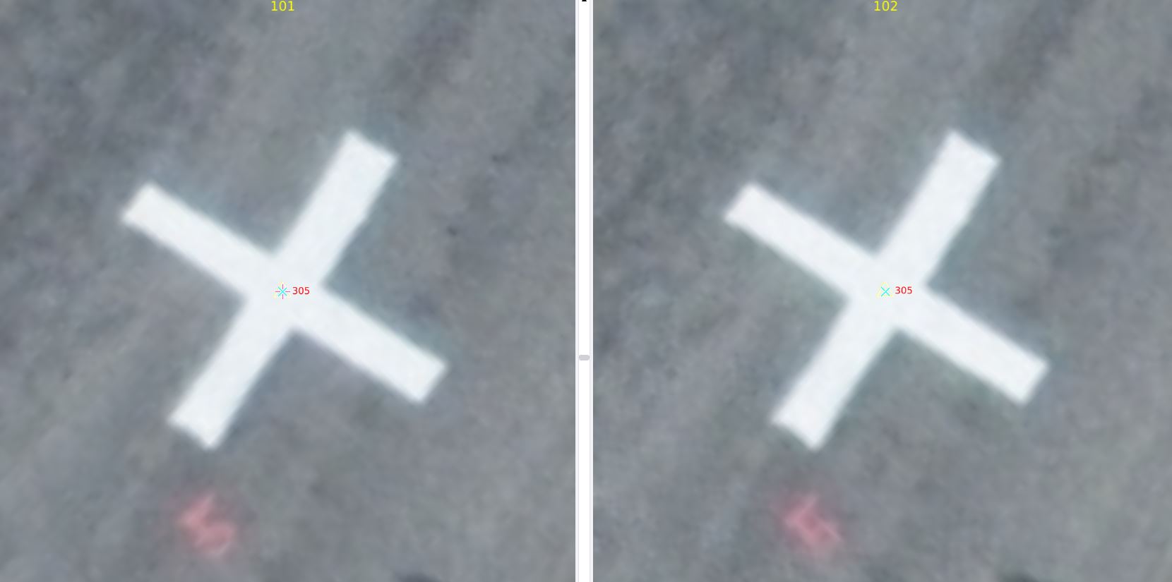
Professional Land Surveyors strategically place ground control points across the survey area; these points serve as benchmarks to anchor the aerial data in three dimensional space.

Support for Land Surveyors
We equip land surveyors with precise aerial data that simplifies complex property and land measurement tasks. This support ensures detailed and reliable surveys, aiding surveyors in their critical work.
Get a Quote for Your Project Today
Ensure your project’s success with detailed and accurate mapping. Request a quote now and see how Synergy Mapping’s Digital Aerotriangulation services can make a difference.
Why Choose Synergy Mapping, Inc.?
Synergy Mapping, Inc. sets the industry standard for digital aerial triangulation due to:

Advanced Technology and Techniques
We employ the newest and most efficient aerial imaging technology and ground control techniques available today. This commitment to using the best tools in the industry ensures the highest accuracy and reliability of data, establishing superior quality in every project we undertake.
Industry-Specific Expertise
Our team boasts extensive experience utilizing the latest technologies and procedures. This deep knowledge allows us to effectively address the unique challenges and adhere to the stringent regulatory standards specific to each sector, providing tailored and effective solutions.

Customized Solutions
Understanding that each project has its own set of unique challenges, we customize our services to match the specific requirements and objectives of each client. This personalized approach ensures that we deliver optimal outcomes tailored to each project’s specific needs.

Extensive Geographic Coverage
Our operations across Colorado, Nevada, California, and the United States provide us with a broad reach, allowing us to deliver timely and efficient services to a diverse client base. This extensive coverage enhances our ability to respond quickly to client needs wherever they are located within these states.

Commitment to Client Satisfaction
We are dedicated to exceeding client expectations at every turn. Our ongoing support and willingness to adapt our services as projects evolve demonstrate our commitment to client satisfaction and project success.
Real Results:
Hear What Our Clients Are Saying
Contact Synergy Mapping, Inc.
Partner with Synergy Mapping, Inc. for leading Digital Aerial Triangulation services and experience unmatched precision and reliability in your aerial mapping needs. Reach out now for a comprehensive consultation and to start your project with the best in the business.
FAQs About Digital Aerial Triangulation
What is aerial triangulation?
Aerial triangulation is a process used in photogrammetry where multiple overlapping photographs are mathematically analyzed and tied together using ground control points to establish the exact position of surface points, essential for creating accurate maps and 3D models.
What is aerial triangulation in photogrammetry?
In photogrammetry, aerial triangulation is the technique of using overlapping aerial photographs and known ground control points to accurately orient photogrammetric models, providing a base framework for all subsequent mapping and orthophoto generation.
What is a Survey Flight?
A survey flight refers to a flight conducted specifically for the purpose of collecting geospatial data. During a survey flight, an aircraft, typically equipped with specialized surveying equipment like cameras, LiDar sensors, or other remote sensing technologies, flies over a designated area to gather necessary data. The flight path is often meticulously planned to ensure complete coverage and optimal data collection of the targeted area.
What is a ground control survey?
A ground control survey involves placing known reference points on the ground which are visible on aerial photographs. These points have precisely measured coordinates that are used to calibrate and correct aerial images.
What are ground control points in surveying?
Ground control points (GCPs) are marked points on the ground with a known geographic location that are used as reference points in aerial surveying and mapping. Using real-world coordinates, these points help in aligning and scaling aerial photographs and satellite images to produce accurate spatial data.
