Digital Topographic Survey Services
Are you searching for “Topographic Survey Services Near Me?”
Are you seeking comprehensive topographic survey services tailored to your industry needs? At Synergy Mapping, Inc., we combine advanced aerial survey techniques with extensive expertise to deliver precise topographical data across Colorado, Nevada, California, and the entire United States. Contact us today to elevate your projects with detailed topographic insights.
At Synergy Mapping, Inc., our focus extends beyond traditional surveying to include specialized topographic survey services that cater to a diverse range of industries. Leveraging our advanced aerial technologies and extensive field expertise, we provide detailed elevation data and contour mapping critical for project analysis and decision-making. Our team’s commitment to precision and quality ensures that each topographic map we produce is a vital tool for clients needing to navigate complex terrain challenges. Whether optimizing a construction layout, planning environmental conservation efforts, or developing new urban areas, our topographic surveys deliver the essential data necessary for comprehensive project planning and successful execution.

An Introduction to Synergy Mapping, Inc.
Welcome to Synergy Mapping, Inc., your premier partner in topographic aerial surveying. Our commitment to excellence in geospatial solutions spans various sectors, from engineering to environmental monitoring. Utilizing the latest in aerial mapping technology, we provide detailed three-dimensional maps that depict both natural and man-made features with precision. These topographic maps are crucial for any project requiring detailed elevation data and landscape analysis.
Unlock Your Project’s Potential
Discover the terrain’s secrets with our precision topographic mapping services. Elevate your project’s planning and execution.
Contact Synergy Mapping, Inc. today—to transform your landscape understanding!We cater to a range of industries
Our topographic survey services are indispensable across various industries, playing a critical role in planning, design, and management:
Construction and Engineering
We provide detailed topographic data essential for accurate site planning, design, and infrastructure development. Our precise elevation and contour mapping ensure construction projects are guided effectively from the initial ground-breaking through to completion, helping to predict potential issues and plan accordingly.
Agriculture and Forestry
In the sectors of agriculture and forestry, our topographic surveys aid in detailed land management, irrigation planning, and the efficient allocation of resources. These surveys are critical for maximizing land use, enhancing crop yield, and implementing sustainable forest management practices that align with environmental conservation goals.
Archaeology
For archaeologists, our topographic maps are crucial tools. They enable the precise location of potential dig sites and provide a deeper understanding of the landscape’s historical context, which is vital for planning excavations and preserving undiscovered artifacts with minimal disturbance.
Disaster Management
Our topographic surveys are instrumental in disaster management by providing essential data for hazard assessment and mitigation planning. This information is vital for developing effective response strategies and improving the resilience of communities to natural disasters.
Mining and Quarries
In the mining and quarry industries, safety and efficiency are paramount. Our accurate topographical data aids in planning and managing extraction processes, enhancing operational safety and efficiency by providing a detailed understanding of site conditions.
Transportation and Infrastructure
Topographic surveys are foundational to the development and maintenance of transportation networks, including roads, bridges, and transit systems. They provide the critical data needed to ensure these structures are designed and built on solid and accurately mapped foundations.
Urban Planning and Development
Our services assist urban planners and developers by providing detailed and precise maps that help optimize land use and integrate new developments seamlessly into existing urban fabrics, considering all terrain constraints.
Environmental Monitoring
We monitor changes in landforms and other environmental features, delivering crucial data for environmental impact assessments and aiding in the conservation of natural habitats.
Utilities and Telecom
For utilities and telecommunications sectors, our topographic data is essential in designing and maintaining infrastructure that must navigate complex terrain, ensuring that services are continuous and disruptions are minimized.
Commercial Real Estate, Oil and Gas, Solar, and Wind Energy
These sectors depend heavily on precise topographic surveys for site selection and infrastructure planning. Our surveys help ensure that installations like pipelines, solar panels, and wind turbines are placed optimally, maximizing efficiency and productivity while minimizing environmental impact.
Explore with Accuracy
Need detailed land insights for your next big project? Tap into our topographic survey expertise and get the high-resolution data you need. Contact us now for a consultation and start your project with confidence!
Contact Synergy Mapping, Inc.Benefits of Using Synergy Mapping, Inc.
By choosing Synergy Mapping, Inc., you benefit from a partnership that brings advanced technology, customized solutions, and extensive expertise to your topographic surveying needs, all delivered with a focus on cost-efficiency and client satisfaction.
High-Resolution Data: Our topographic maps are distinguished by their exceptional detail, featuring finely measured elevation points and clearly defined contour lines. This high level of resolution provides clients with a comprehensive and intricate view of the surveyed area, enabling precise analysis and informed decision-making for any project.
Advanced Technology: At Synergy Mapping, Inc., we exclusively utilize manned aircraft equipped with the latest high-sensitivity sensor technology to capture the most accurate topographical data. This approach harnesses the advantages of powerful imaging capabilities and extensive reach, allowing for precise data collection over extensive and challenging terrains. Employing manned aircraft ensures robustness and reliability in our operations, minimizing human error and significantly enhancing the quality and accuracy of the resulting maps. This method not only provides superior coverage and data integrity but also adheres to the stringent regulations governing aerial surveys, ensuring safety and compliance in all our projects.
Customizable Solutions: We understand that each project has unique challenges and requirements. Our topographic survey services are highly customizable, designed to meet the specific needs of diverse projects across industries such as construction, environmental management, and urban planning. This tailored approach ensures that our surveys directly contribute to the successful execution and enhanced outcome of your projects.
Extensive Experience: With decades of collective expertise in topographic surveying, our team at Synergy Mapping, Inc. brings a depth of knowledge and a wealth of experience to every project. This extensive background ensures that we provide reliable, accurate, and actionable results, making us a trusted partner in various sectors.
Cost-Effective: We strive to offer our topographic survey services at competitive prices without compromising on quality or efficiency. Our commitment to utilizing advanced technology and efficient processes reduces overall costs, allowing us to pass these savings on to our clients. This makes our topographic surveys not only a valuable tool for precise planning and development but also a cost-effective solution that maximizes the return on your investment.
Our Topographic Survey Services
Each of these services integrates our state-of-the-art topographic mapping capabilities with a deep understanding of industry-specific requirements, delivering tailored solutions that help our clients achieve their project goals with precision and efficiency:

Topographic Mapping
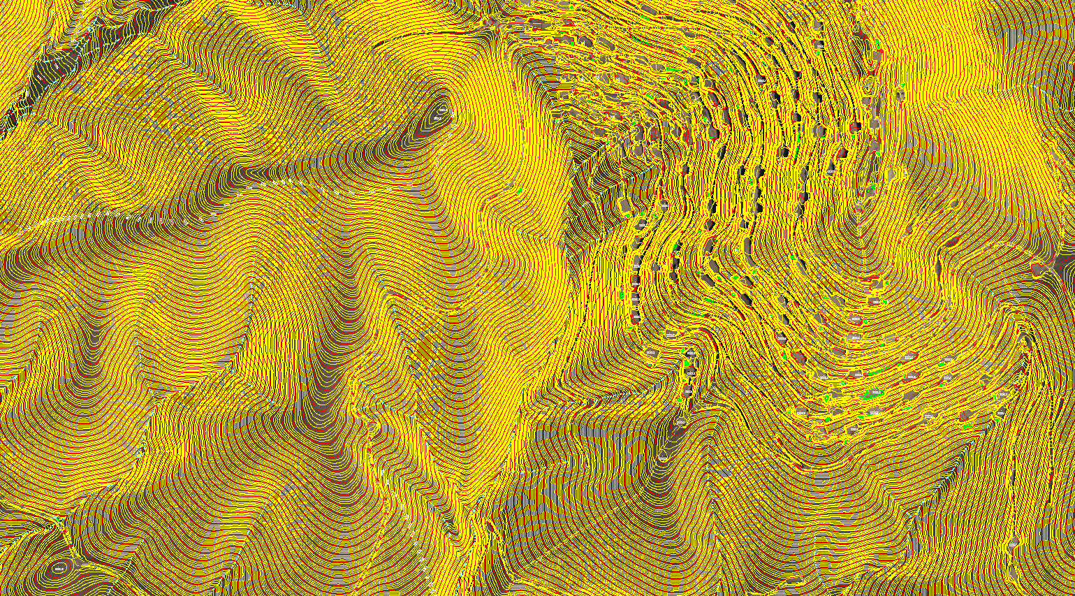
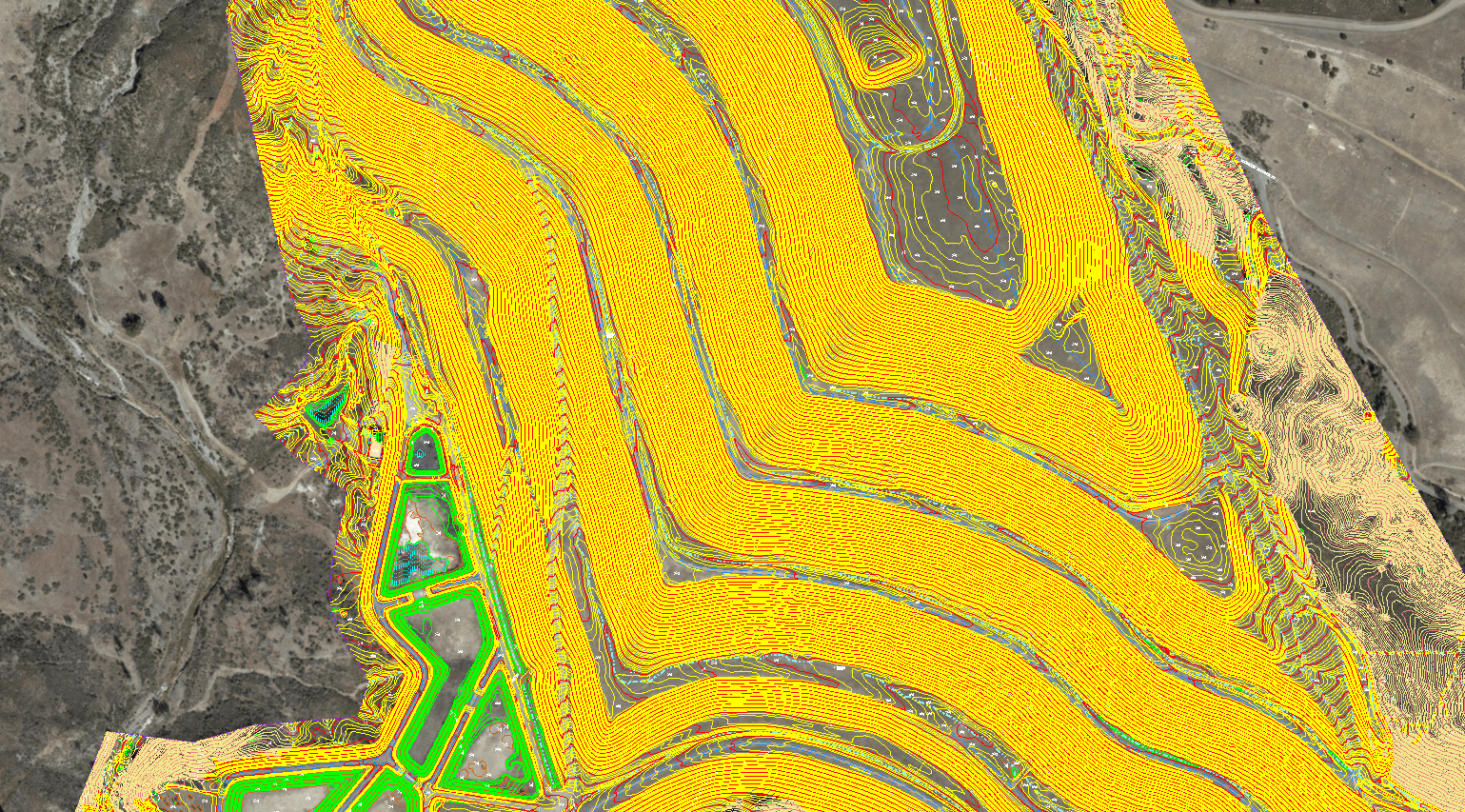
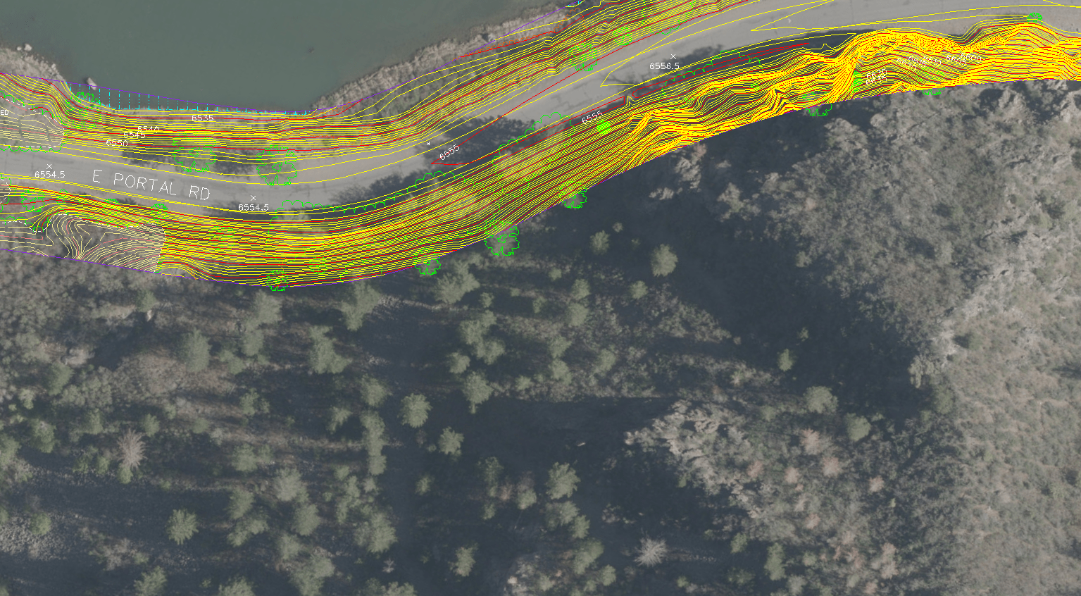
At Synergy Mapping, Inc., our topographic mapping service is fundamental to accurately representing the relief and elevation of terrain through detailed contour lines and spot elevations. This method provides a graphic depiction of both natural and man-made features within a specific area, presenting their horizontal and vertical positions in a clear and interpretable manner. Our maps serve as essential tools for a variety of planning and analysis tasks.

Detailed Terrain Analysis
Leveraging the precision of our topographic mapping, we offer comprehensive terrain analysis services. This includes detailed examination of land surface characteristics crucial for engineering, construction, and environmental planning. Our analysis helps in understanding the lay of the land, identifying potential issues like drainage problems or instability that could impact project development.
Volumetric Calculations
Essential for sectors like mining, quarry management, and construction, our topographic surveys facilitate precise volumetric calculations. These calculations determine the volume of earth to be moved or resources to be extracted, enabling effective resource management and operational planning. Accurate volumetric data supports cost estimation and helps ensure compliance with environmental regulations.

Environmental Impact Studies
Our topographic surveys are instrumental in conducting environmental impact studies. By assessing how proposed developments could alter the landscape, we help project stakeholders make informed decisions that align with sustainable development practices. These studies evaluate potential impacts on local ecosystems, water flow, and land stability, ensuring that development projects proceed with minimal environmental disruption.
Master Your Terrain
Master the complexities of your project site with our advanced topographic mapping services. Connect with our experts at Synergy Mapping, Inc. and ensure your development is built on a solid foundation. Reach out today!
Contact Synergy Mapping, Inc.Why Choose Synergy Mapping, Inc.?
Choosing Synergy Mapping, Inc. means opting for a provider that combines technical excellence with a deep commitment to client satisfaction, ensuring that every topographic survey you entrust to us contributes positively to the success of your projects.

Expertise and Precision
At Synergy Mapping, Inc., our team consists of highly skilled professionals who specialize in topographic surveying. We are committed to delivering surveys with unmatched accuracy and detail. Utilizing advanced methodologies and the latest technology, including manned aircraft equipped with state-of-the-art sensors, we ensure the reliability and precision of every map we produce. Our rigorous quality control processes further guarantee that each project outcome meets the highest standards of accuracy, providing you with dependable data for your critical decisions.

Wide Coverage
Synergy Mapping, Inc. has a robust operational presence that spans Colorado, Nevada, California, and extends across the entire United States. Our wide coverage ensures that we can provide high-quality topographic survey services wherever our clients’ projects are located. Whether it’s a remote mining site or a bustling urban development, our team is equipped and ready to deliver top-notch services with the same level of expertise and commitment..

Client-Centric Approach
We believe that each project is unique, and personalized engagement with our clients is key to our success. At Synergy Mapping, Inc., we dedicate time to understanding the specific needs and objectives of each client. This client-centric approach allows us to tailor our topographic survey services to meet the precise requirements of your project, ensuring outcomes that are not only accurate but also highly relevant to your needs. Our team works hand-in-hand with clients throughout the survey process, from initial consultation to final delivery, providing support and adapting our services to your evolving project demands.

Comprehensive Service Offering
Synergy Mapping, Inc. offers a full suite of topographic survey services that include detailed land feature analysis, elevation and contour mapping, volumetric measurements, and more. This comprehensive service offering ensures that whatever your project’s topographic needs, we have the capabilities to address them effectively.

Long-Term Partnership
We view each project not just as a transaction but as an opportunity to build a lasting relationship. By choosing Synergy Mapping, Inc., you gain a reliable partner dedicated to supporting your projects’ success over the long term, with ongoing support and services adapted to the changing needs of your business and the industry.
Real Results:
Hear What Our Clients Are Saying
Contact Synergy Mapping, Inc.
Ready to start your project with the best in topographic surveying? Contact Synergy Mapping, Inc. today for a consultation and discover how our expert services can make a difference in your next project.
FAQs About Topographic Surveys
What is a Topographical Survey?
A topographical survey, also known as a land survey, is a detailed examination and mapping of the features of a specific area. This type of survey captures both the natural and man-made elements of the terrain, providing three-dimensional data on elevations, depressions, and features of the landscape. The primary purpose is to create an accurate representation of the area, including hills, valleys, streams, buildings, and other relevant details that influence land use decisions and project planning.
How are Topographic Surveys Done?
Topographic surveys are conducted using a variety of methods depending on the size of the area and the detail required. Common tools include:
– Total Stations: Combining electronic distance measurement and angles to calculate exact positions.
– GPS (Global Positioning System): Utilizing satellites to provide precise location data, particularly effective over large, open areas.
– Laser Scanning (LiDAR): Emitting laser beams to measure distances and gather precise data points quickly over large areas or complex environments.
– Aerial Photography and Drone Surveys: Capturing images from above and using photogrammetry to measure and record topographic data.
– Traditional Leveling Instruments: Used for determining elevation differences by sighting through a level telescope.
What are Topographic Maps?
Topographic maps are detailed, accurate graphic representations of three-dimensional features on the Earth’s surface. Unlike simple road maps, topographic maps depict elevation, usually through contour lines, as well as water bodies, vegetation, roads, and important landmarks. These maps are essential tools in planning and decision-making for environmental management, construction, and outdoor activities like hiking and land navigation.
What Does the Topographic Map Show?
Topographic maps show:
– Contours Lines: Indicate elevation and the shape of the terrain. Close lines indicate steep slopes, while distant lines suggest flat surfaces.
– Vegetation: Different symbols or shades may represent woods, orchards, or vineyards.
– Water Bodies: Lakes, rivers, and streams are clearly marked.
– Man-made Features: Buildings, roads, dams, and other infrastructure.
– Landmarks: Churches, towers, and other notable landmarks. These elements are used to depict the area’s topography in a useful and functional way.
How Do I Read a Topographic Map?
Reading a topographic map involves understanding its key elements:
– Study the Legend: Familiarize yourself with the symbols and scale used on the map.
– Identify Contour Lines: These lines show elevation and the shape of the terrain. Note that contour intervals (the elevation difference between lines) provide insights into the steepness of the area.
– Look at Colors and Symbols: Different colors and symbols represent various natural and man-made features.
– Use the Scale: The map scale helps determine distances between points on the map. A ruler can be used to convert distances on the map to actual ground distances.
– Check the Orientation: Most maps are oriented with north at the top. Use a compass to align the map correctly with the actual directions.
Understanding these elements will help you effectively interpret and use topographic maps for planning, navigation, or any other purpose requiring detailed knowledge of the terrain.
