Digital Planimetric Maps Services
Are you searching for “Planimetric Mapping Services Near Me?”
At Synergy Mapping, Inc., discover advanced Planimetric Mapping services designed to meet the precision needs of industries ranging from construction to environmental monitoring. Utilizing cutting-edge technology and expert techniques in aerial surveying, our services ensure meticulous mapping and detailed analysis in Colorado, Nevada, California, and across the United States. Contact us today to revolutionize your project’s mapping needs with unparalleled accuracy.
At Synergy Mapping, Inc., we are dedicated to delivering high-quality planimetric mapping services, tailoring our high-resolution solutions to meet the specific needs of various industries. With state-of-the-art technology and a team of experienced professionals, we ensure precise and comprehensive mapping that enhances project planning and execution across a wide array of sectors.

An Introduction to Synergy Mapping, Inc.
Welcome to Synergy Mapping, your expert in Planimetric Maps. Our services are essential for accurately capturing the two-dimensional geographic features of an area without elevation data, providing detailed maps for a variety of projects. We serve a broad spectrum of industries, from urban development to solar energy, ensuring each project benefits from high-quality imagery and precise mapping.
Enhance Your Planning with Precision
Tap into the precision of our Planimetric Maps for your next project.
Contact Synergy Mapping, Inc. todayWe cater to a range of industries
Planimetric mapping is critical for a wide range of applications, offering detailed layouts of natural and man-made features on the earth’s surface. Here’s how different industries benefit from our Planimetric Maps:
Engineering & Construction
Our planimetric maps provide critical accuracy in layout and design, facilitating detailed planning and effective oversight of construction projects. This precision aids in the meticulous arrangement of site elements, ensuring compliance with design specifications and regulatory standards.
Agriculture
Precision in field layout and resource management is key. Our maps enable effective crop rotation, irrigation planning, and pest management strategies that optimize output and ensure sustainable agricultural practices.
Forestry
Our mapping services are essential for forest inventory management, tracking changes in forest cover and assisting in the strategic planning of logging activities, which helps maintain ecological balance and compliance with environmental regulations.
Archaeology
By providing high-resolution images of historical sites, our maps help archaeologists plan digs and preserve undiscovered artifacts with minimal disruption to the surrounding area.
Disaster Management
In emergency situations, our maps provide responders with detailed layouts of affected areas, crucial for organizing effective response efforts and minimizing the impact of natural disasters.
Mining and Quarries
For the mining sector, our maps enhance operational safety and efficiency by accurately depicting site topography, which helps in planning extraction processes and managing earth-moving activities.
Transportation and Infrastructure
Our maps support the design and maintenance of infrastructure by providing accurate representations of existing road networks and potential new routes, facilitating smoother project implementations.
Urban Planning and Development
We offer urban planners precise mapping tools that assist in the thoughtful integration of new developments into existing urban landscapes, ensuring that growth is both sustainable and well-organized.
Environmental Monitoring
Utilized for environmental impact assessments, our maps help monitor ecological changes and enforce environmental protection measures.
Utilities and Telecom
For utilities and telecom industries, our maps assist in the planning and deployment of network infrastructure, enhancing service delivery and operational efficiency.
Commercial Real Estate
Our maps provide detailed property layouts that help real estate developers and marketers visualize site potential and optimize property layouts for prospective clients.
Oil and Gas
We support the oil and gas industry with maps that aid in exploration and monitoring, ensuring safe and efficient pipeline and facility placements.
Solar Energy
Our maps assist in the optimal placement and angle of solar panels to maximize energy absorption and efficiency.
Wind Energy
For wind energy projects, our detailed mapping supports the strategic placement of turbines to harness wind resources effectively.
Get Started Now!
Don’t wait to improve your project outcomes. Contact Synergy Mapping, Inc for detailed Planimetric Mapping!
Contact Synergy Mapping, Inc.Benefits of Using Synergy Mapping, Inc.
Enhanced Project Visualization: Our planimetric maps offer unmatched clarity and detail, providing comprehensive views of project sites. These high-resolution maps add critical visual context that aids stakeholders in making informed decisions, simplifying complex planning processes and enhancing the accuracy of projected outcomes.
Speed and Efficiency: Synergy Mapping, Inc. prides itself on its swift deployment and rapid data processing capabilities. By minimizing the time from initial data capture to final map delivery, we help keep your projects moving forward without delay, ensuring that critical deadlines are met and that project momentum is maintained.
Industry Customization: Our planimetric mapping services are highly specialized and tailored to meet the exact needs of various industries including construction, environmental management, urban planning, and more. By understanding the specific challenges and requirements of each sector, we create maps that are not only accurate but also perfectly suited to the particular applications of each client, thereby enhancing the overall effectiveness of project planning and implementation.
Extensive Area Coverage: With the capability to cover vast geographic areas, from rural expanses to dense urban environments, our planimetric maps provide comprehensive support for projects of any scale. Whether you are managing a small development or a large-scale infrastructure project, our services ensure that every part of your project area is meticulously mapped and documented.
Cost Efficiency: Leveraging state-of-the-art technology and streamlined mapping processes, Synergy Mapping, Inc. delivers high-quality planimetric maps at a cost-effective price point. Our efficient use of resources reduces overall project costs for our clients, making our high-definition mapping solutions an excellent investment for enhancing project precision and reducing the risk of costly planning errors.
Our Planimetric Map Services
At Synergy Mapping, Inc., we are committed to delivering meticulously crafted planimetric maps that harness the most advanced technologies available. Our services are specifically designed to provide unmatched detail and accuracy, catering to a wide array of professional needs across various industries:
Aerial Mapping Services
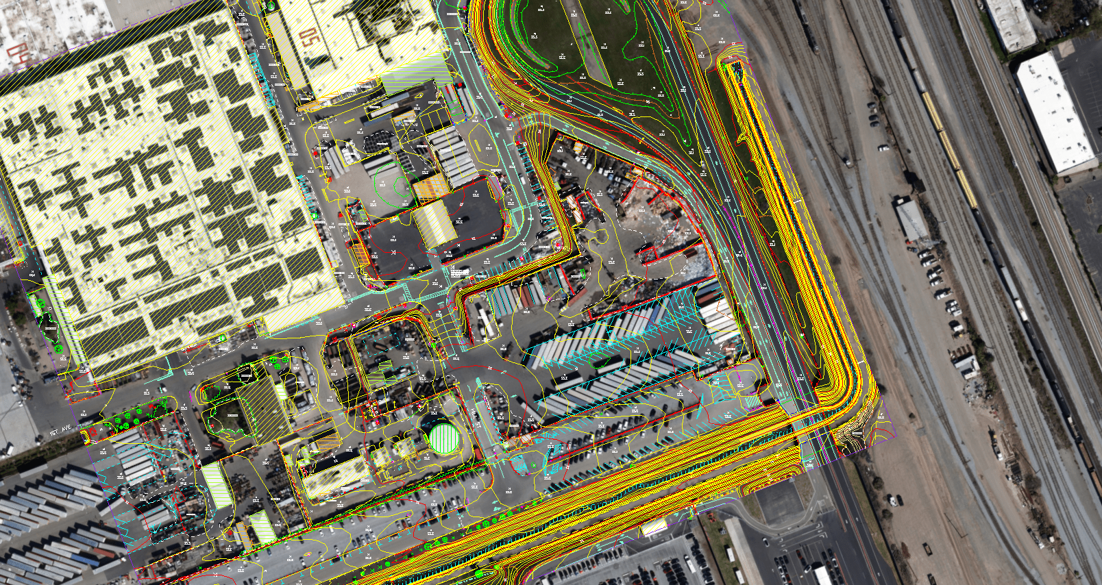
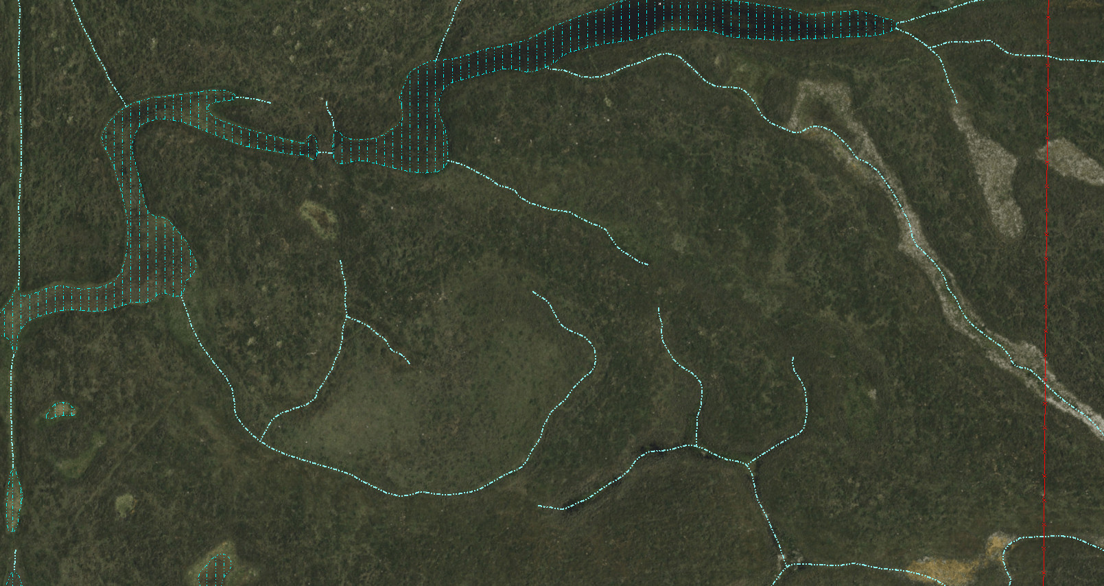
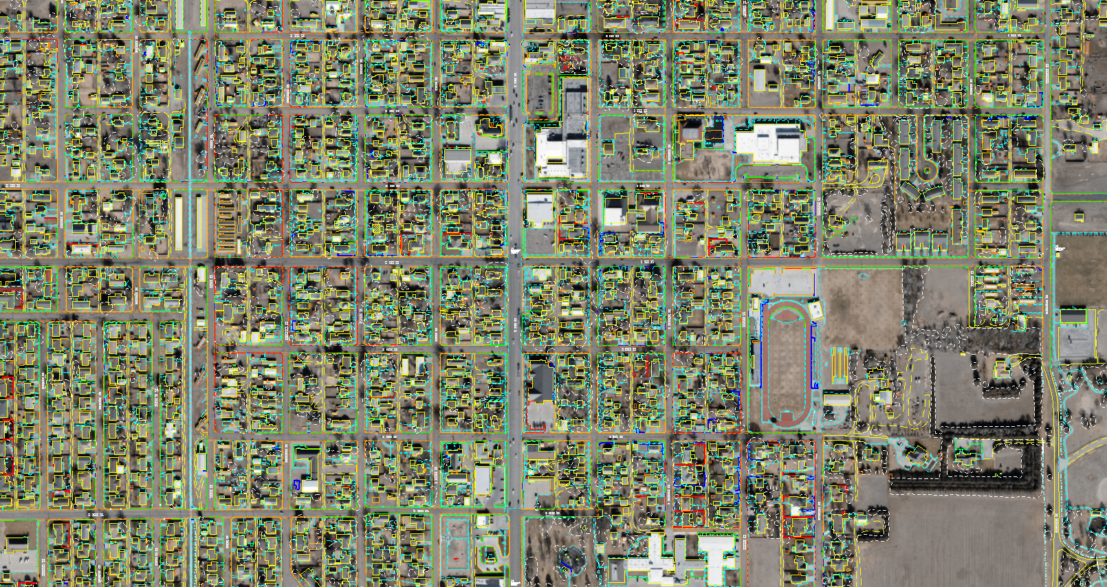
We specialize in capturing high-resolution aerial photographs that are then transformed into detailed planimetric maps. These maps display all visible ground features such as buildings, roads, and vegetation without topographical details, crucial for accurate site analysis and project planning.
Land Surveying Support
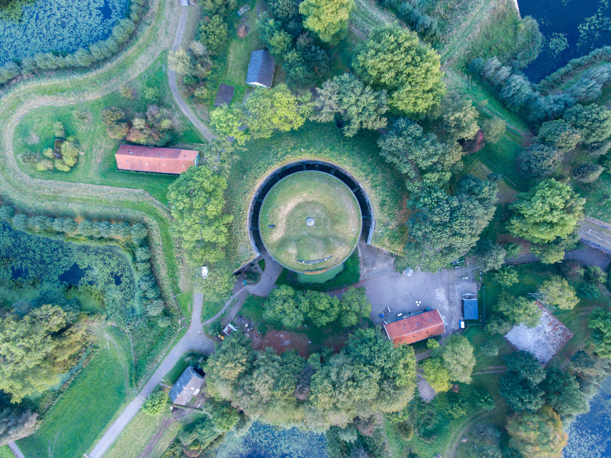
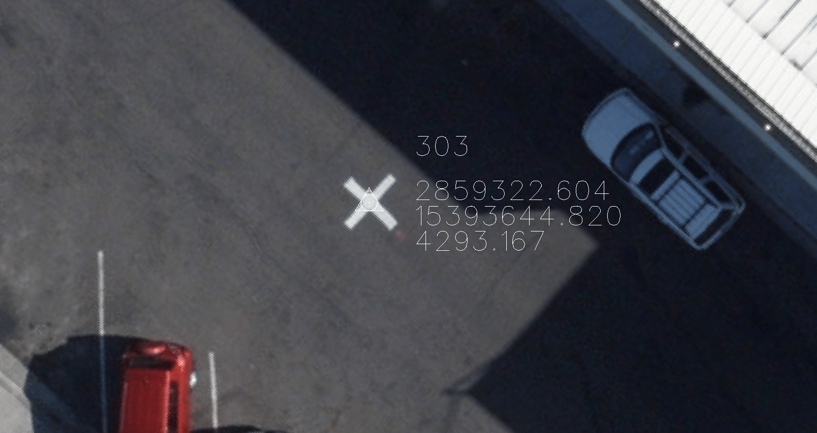
Our planimetric maps serve as essential tools for land surveyors, enhancing their ability to perform precise measurements and property assessments. By providing accurate representations of land parcels and structural boundaries, our maps improve the efficiency and accuracy of land surveying activities.
Infrastructure Mapping
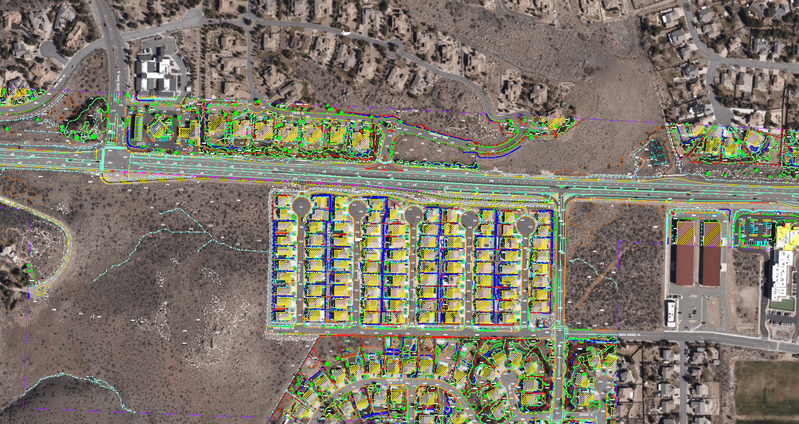
We produce comprehensive maps that detail existing infrastructure elements, crucial for the planning and development of new projects as well as the maintenance of existing facilities. These maps are invaluable for engineers and planners involved in the expansion of utilities, roadways, and other critical infrastructure components.

Environmental Analysis
Our planimetric mapping services play a vital role in environmental conservation and analysis efforts. By accurately documenting the current state of natural landscapes and human-made environments, our maps help environmental scientists monitor ecological changes, assess the impact of developments, and plan effective conservation strategies.
Urban Development Mapping
We support urban planners and developers by providing detailed planimetric maps that aid in the thoughtful design and integration of new developments into existing urban frameworks. These maps are instrumental in visualizing the spatial distribution of urban features, helping to optimize land use and improve the coherence of urban expansion plans.
Request Your Detailed Map
Ready for detailed planning? Contact Synergy Mapping for a custom Planimetric Map tailored to your needs!
Contact Synergy Mapping, Inc. Today!Why Choose Synergy Mapping, Inc.?
By choosing Synergy Mapping, Inc., you’re partnering with a leader in planimetric mapping, where advanced technology, industry expertise, and tailored solutions come together to deliver exceptional results.

Advanced Mapping Techniques
At Synergy Mapping, Inc., we utilize the forefront of aerial imaging and photogrammetric analysis technology. This cutting-edge approach allows us to create the most precise and high-quality planimetric maps available on the market. We implement sophisticated data capture techniques, to ensure every map is rich in detail and free from distortions, providing a true representation of the landscape.

Expertise Across Industries
Our years of experience have equipped us with a profound understanding of the different requirements across various sectors such as construction, environmental management, urban planning, and more. We’ve honed our skills to develop specialized mapping solutions that adhere strictly to the nuanced standards and practices of each industry, ensuring that every map we deliver is not only accurate but fully compliant with sector-specific regulations and needs.

Customized Mapping Solutions
We believe that no two projects are the same and that each client’s needs are unique. At Synergy Mapping, we tailor our services to the distinct challenges and specific requirements of each project. By closely working with our clients, we gather detailed insights into their objectives and requirements, enabling us to create planimetric maps that are not just functional but perfectly aligned with the project’s goals.

Broad Geographic Coverage
Synergy Mapping boasts an expansive operational footprint that spans Colorado, Nevada, California, and extends across the entire United States. This wide-reaching capability ensures that we can offer our high-quality mapping services wherever our clients are located, providing them with timely and effective solutions that are critical to the success of their projects.

Dedicated Client Support
Our commitment to achieving and maintaining high client satisfaction is reflected in our comprehensive client support system. From the initial consultation to the final delivery and post-delivery support, our team is always available to assist with any queries or adjustments needed. This dedicated support ensures a seamless process and builds strong, lasting relationships with our clients, emphasizing our commitment to not just meet but exceed their expectations.
Real Results:
Hear What Our Clients Are Saying
Contact Synergy Mapping, Inc.
Ready to enhance your projects with superior Planimetric Mapping services? Contact Synergy Mapping, Inc. to discuss how we can bring detailed and accurate mapping solutions to your industry. Reach out now for a detailed consultation and to begin your project with the best in digital mapping expertise.
FAQs About Planimetric Maps
What is a Planimetric Map?
A planimetric map is a detailed representation of the geographic features of an area, depicted purely in two dimensions. It accurately displays all visible elements on the ground such as buildings, roads, trees, and rivers, but it does not include topographical data like elevations. This type of map is strictly concerned with the horizontal positions of features, making it invaluable for any analysis that requires an exact understanding of spatial relationships and layouts.
What are Planimetric Maps Useful For?
Planimetric maps serve a wide array of purposes across different fields. In urban planning, they provide a clear layout of city infrastructure, aiding in the design and modification of urban environments. Construction projects rely on these maps for site planning and monitoring, ensuring accurate placement of structures. They are also essential in environmental management for assessing land use changes, and in emergency management for planning response strategies where detailed spatial awareness of an area is crucial.
Planimetric Map vs Topographic Map: What’s The Difference?
While both types of maps are crucial in geographic representation, they serve different purposes. Planimetric maps focus exclusively on horizontal measurements and the arrangement of features on the Earth’s surface, providing clear, flat representations without elevation data. Topographic maps, on the other hand, include contour lines and symbols that represent three-dimensional terrain elevations. This makes topographic maps ideal for geological studies, hiking, and other activities requiring elevation details, whereas planimetric maps are preferred for projects needing detailed views of surface features.
What are some examples of Planimetric Maps?
Common examples of planimetric maps include city zoning maps, which outline the divisions of a city into zones according to planned use of land; property boundary maps, which show the defined boundaries of individual properties; and park maps, which detail the layout of parks including paths, facilities, and natural features. These maps are utilized by government agencies for regulatory purposes, by architects and developers for construction, and by public safety organizations for operational planning.
What is the Legend Called on Planimetric Maps?
The legend on a planimetric map, often simply called a “legend” or “key,” is a crucial element that explains the symbols, colors, and notations used on the map. This feature helps users interpret the various graphical representations on the map accurately, ensuring that they understand the types of features depicted, such as water bodies, land use, building types, and other critical geographical elements.
