In today’s world of rapidly advancing technology, UAV surveying and mapping has become a popular topic. Many discussions revolve around the use of UAVs in aerial surveying, however, for certain critical applications, manned aircraft continues to offer unparalleled advantages. This article explores the capabilities of both manned and unmanned aircraft in aerial surveys and aerial mapping, highlighting why manned aircraft remain essential for specific projects. Synergy Mapping, Inc. specializes in aerial surveying and mapping using manned aircraft, offering a unique set of benefits for our clients.
What is UAV for Surveying and Mapping?
UAV surveying and mapping utilizes unmanned aerial vehicles (UAVs, also known as drones) to capture aerial imagery and LiDAR data. The data collected is then used to create maps, 3D models, and other geospatial products for applications ranging from land surveying and urban planning to environmental monitoring and resource management. While UAV’s are valuable tools, they aren’t suitable for every project. Synergy Mapping, Inc., an aerial survey company in Colorado specializing in photogrammetry and LiDAR mapping using manned aircraft offers distinct advantages that often surpass the capabilities of UAVs.
What are the Advantages of using Drones for Surveying and Mapping?
Using drones for surveying and mapping offers several advantages, particularly for smaller, localized projects.
- Reduce Field Time and Costs to Survey Crews: Drones for surveying can, in most cases, reduce field time and potentially offer lower initial costs compared to traditional surveying methods, which translates to reduced costs for survey crews. For smaller, easily accessible sites, the deployment of a drone can be quicker than mobilizing a full ground survey crew. This faster deployment can translate to lower initial costs, especially if the project scope is limited.
- Provide Accurate and Exhaustive Data: Drones can collect high-resolution data, providing detailed information about a site. The ability to fly at lower altitudes allows drones to capture highly detailed imagery, which can be processed to create orthomosaics, point clouds, and 3D models. This level of detail can be beneficial for applications such as stockpile volumetric measurements, construction site monitoring, and infrastructure inspection.
- Map Otherwise Inaccessible Areas: In some situations, drones can access areas that are difficult or dangerous to reach on foot. This can be particularly useful for surveying hazardous terrain, such as steep cliffs, dense forests, or areas contaminated with hazardous materials. Drones can also be used to inspect bridges, pipelines, and other infrastructure in areas that are difficult to access by traditional methods.
Do You Need Accurate Aerial Surveys?
Synergy Mapping, Inc. provides precise, efficient, and accurate aerial surveying services, including topographic information, for land surveyors and engineering firms. From development planning to high-resolution orthomosaic imagery, our experienced team and manned aircraft deliver unparalleled data accuracy. Contact us today for a consultation. to discuss your specific need
Contact Synergy Mapping, Inc.What are Drones Used for in Surveying?
Drones are used for various aerial surveying tasks, including:
- Land Surveying: Drones can be used to collect aerial imagery that is then processed using photogrammetric techniques to create orthomosaics and digital elevation models. These products can be used for a variety of land surveying and cartographic applications, including boundary surveys, topographic mapping, and creating base maps for GIS. Some companies specialize in drone land surveying and employ drone surveyors to conduct drone property surveys.
- Land Management and Development: By capturing aerial imagery at regular intervals, drones can be used to track changes in land cover, vegetation growth, and construction progress. This information can be valuable for land management planning, environmental monitoring, and urban development projects. However, the limited flight time and payload capacity of drones can be a constraint for large areas.
- Precise Measurements: Drones enable precise measurements for a variety of applications, including stockpile volumetric measurements, and other tasks requiring detailed geospatial data. Their ability to capture high-resolution imagery and create accurate 3D models allows for precise calculations and analysis. For example, in stockpile management, drones can quickly and accurately determine the volume of materials, aiding in inventory control and resource management. For slope monitoring, they can capture data over time, allowing for the detection of even subtle changes that could indicate potential hazards.
- Urban Planning: Drones provide valuable data for a wide range of urban planning applications. By collecting high-resolution aerial imagery and creating 3D models of urban areas, planners gain detailed insights into existing conditions and potential development scenarios. This data supports informed decision-making in areas such as transportation planning (e.g., traffic flow analysis, route optimization), infrastructure development (e.g., utility placement, road design), and urban design (e.g., building placement, green space development). The ability to capture current conditions and visualize future development options enhances the planning process and facilitates stakeholder engagement.
What Kinds of Deliverables Can You Get with UAV Land Surveying?
UAV land surveying produces a variety of useful deliverables, including:
- Digital orthomosaic maps (highly accurate, georeferenced images)
- Point clouds (detailed sets of data points representing the surveyed area)
- Digital surface models (DSMs) (representing the earth’s surface including buildings and vegetation)
- Digital terrain models (DTMs) (representing the bare earth surface)
- 3D textured mesh (realistic 3D representations of the area)
- Contour lines (showing elevation changes)
How Accurate is a Drone Survey?
The accuracy of a drone survey depends on several factors, including the quality of the drone, the measurement of control points, the quality of the onboard sensors and the processing software. While drones can achieve high levels of relative accuracy, their absolute accuracy is often limited by the accuracy of the ground control points and ground sample distance. For most projects, centimeter-level accuracy is achievable.
Capture Your World from Above
Our digital aerial photography services provide stunning visuals and valuable data for a wide range of applications. Explore our aerial photography services and let us help you capture your vision.
Explore Aerial Photography ServicesManned Aircraft in Surveying and Mapping
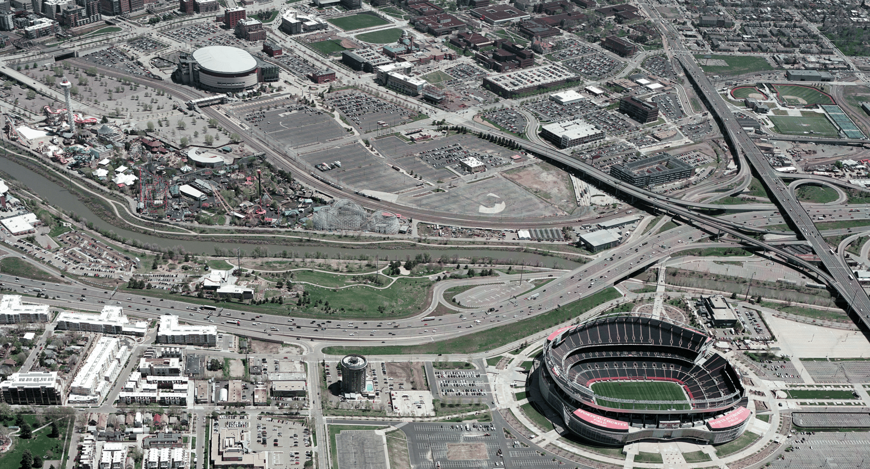
Manned aircraft in surveying and mapping involves using aircraft piloted by humans to capture aerial imagery and other survey data. Synergy Mapping, Inc. specializes in this method, leveraging its unique advantages. Manned aircraft are equipped with sophisticated sensors and can operate at a higher range of altitudes, allowing them to cover a variety of small to large areas quickly and efficiently. This makes them ideal for a variety of small to large-scale projects requiring high accuracy and detailed geospatial information.
What are the Advantages of Manned Aircraft in Surveying and Mapping?
Manned aircraft offer several key advantages for specific surveying and mapping projects:
- Reduce Control Locations: Higher altitude and advanced sensors mean manned aircraft need fewer control points, saving time and money, especially on large-scale projects, but can be used in smaller to medium scale projects. Drones fly lower, requiring exponentially more images (and thus more ground control) to cover the same area. Fewer ground control points also minimize environmental impacts, particularly in sensitive areas.
- Extensive Coverage: Manned aircraft, with their extended flight time, can cover vast areas in a single operation. This capability makes them ideal for large-scale projects such as regional mapping, corridor mapping for pipelines or highways, and environmental monitoring of large ecosystems. This extensive coverage reduces the overall project timeline and minimizes the number of flight lines required, further contributing to cost savings.
- Time efficient: Manned aircraft significantly reduce project timelines compared to drones, completing projects covering the same area in a fraction of the time. This speed is further enhanced by less laborious post-processing, as higher-altitude flights require fewer images to capture the entire project area.
- Higher Altitude Capabilities: Operating at higher altitudes allows for broader coverage and reduces the number of flight lines required. This translates to greater efficiency and reduced project time. Higher altitude also minimizes the impact of terrain variations on data acquisition, ensuring consistent data quality across the entire project area.
- Payload Capacity: Manned aircraft can carry heavier, more sophisticated sensors, enabling the collection of diverse data types. This includes high-resolution cameras, LiDAR systems, thermal imagers, and hyperspectral sensors. The ability to carry multiple sensors simultaneously allows for the collection of a rich dataset, providing a more comprehensive understanding of the surveyed environment.
- Less Susceptible to Weather: Manned aircraft can often operate in weather conditions that would ground drones, this includes wind speed. This greater tolerance to weather conditions minimizes project delays and ensures that data collected can proceed even when conditions are less than ideal.
- Regulatory Restrictions:.While manned aircraft are more heavily regulated in terms of pilot licensing, airworthiness, and flight operations, drones face tighter restrictions on flight conditions like altitude limits, line-of-sight rules, and no-fly zones.
What are Manned Aircraft in Surveying Used For?
Manned aircraft are used for a wide range of surveying applications, including:
- Land Surveying / Cartography: Creating highly accurate maps and geospatial data for various purposes. Manned aircraft are well-suited for small to large-scale topographic mapping, cadastral surveys, and creating base maps for GIS. The high accuracy and extensive coverage capabilities of manned aircraft ensure that the resulting maps are reliable and up-to-date. Numerous case studies demonstrate the effectiveness of manned aircraft for small to large-scale mapping projects, such as highway expansions and urban development planning.
- Land Development and Management: Monitoring land use, development, and environmental changes over diverse areas. Manned aircraft can be used to track changes in land cover, forest health, and urban development over time. This information is essential for land management planning, environmental monitoring, and resource management.
- Accurate Measurements: Acquiring accurate measurements for engineering projects, construction, and other applications. Manned aircraft are used for tasks such as corridor mapping for roads and pipelines, volumetric calculations for large stockpiles, and monitoring subsidence or other ground deformation.
Manned Aircraft Surveying Deliverables
Manned aircraft surveying produces a wide range of deliverables, including:
- Imagery-based products: Orthomosaics, true orthophotos, Digital Elevation Models (DEMs), Digital Terrain Models (DTMs), Digital Surface Models (DSMs), and GPS data.
- LiDAR-derived products: Point clouds, classified point clouds, bare earth models, contour lines, and 3D building models.
- Other deliverables: Thermal imagery, hyperspectral imagery, and GIS data.
How Accurate is a Manned Aircraft Survey?
Manned aircraft surveys can achieve extremely high levels of accuracy down to centimeter-level accuracy, thanks to the sophisticated equipment and techniques used. Utilizing cutting edge cameras we can achieve image quality down to 2.5cm GSD. This high accuracy is essential for many applications, such as engineering design, construction, and precise mapping.
Unlock the Power of Photogrammetry
Synergy Mapping’s expert photogrammetry services provide highly accurate 3D models and geospatial data derived from aerial imagery. Explore our aerial photogrammetry services and let us help you achieve your goals.
Explore Aerial Photogrammetry ServicesWhy Manned Aircraft Still Rule the Skies
While drones have become a valuable tool for certain surveying and mapping tasks, manned aircraft continue to be essential for small to large-scale projects, complex terrain and applications requiring the highest levels of accuracy. Synergy Mapping, Inc. is proud to offer our expertise in manned aircraft surveying and mapping, providing clients with the most reliable and comprehensive geospatial solutions.
Frequently Asked Questions
What is drone mapping?
Drone mapping leverages the agility and maneuverability of drones to acquire aerial imagery, often for smaller-scale projects or areas requiring close-up views. The data is then processed into maps, 3D models, and other geospatial data.
What is UAV mapping?
UAV mapping is a more general term, referring to the use of any unmanned aircraft including drones to collect aerial data for mapping purposes.
What is an aerial mapping survey?
An aerial mapping survey is a method of data collection for map creation that uses aircraft, either manned or unmanned, to capture information about the terrain and features below.
Why use manned aircraft for aerial mapping and surveying?
Manned aircraft excel when projects demand extensive coverage, high accuracy, the ability to carry diverse and heavy sensor payloads, or the capacity to operate in a wider range of weather conditions. They are a reliable solution for small to large-scale initiatives and complex environments.
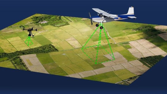
Manned aircraft vs. unmanned aircraft, what’s the difference?
Beyond the obvious presence or absence of a pilot, the distinction lies in their respective strengths. Manned aircraft are typically better suited for small to large, complex, and demanding projects, while unmanned aircraft (like drones) often provide a more accessible and cost-effective approach for smaller, more localized surveys. Each has its own ideal applications.