Oblique Imagery Services
Are you Searching For “Oblique Imagery Services Near Me?”
At Synergy Mapping, Inc., we specialize in oblique imagery, offering unique aerial perspectives that enhance understanding and visualization for projects in urban planning, real estate, and environmental studies. Our state-of-the-art cameras and experienced pilots capture high-quality oblique photographs, serving Colorado, Nevada, California and the United States. Contact us today to elevate your project insights with our professional oblique aerial imagery.
At Synergy Mapping, Inc., we specialize in oblique imagery, aligning our high-resolution imaging solutions perfectly with specific industry needs. With our advanced technology and a team of skilled professionals, we are committed to delivering expansive and detailed aerial views that enhance understanding and planning across diverse sectors.

An Introduction to Synergy Mapping, Inc.
Welcome to Synergy Mapping, your premier provider of oblique imagery services. Specializing in capturing images at an angle rather than directly overhead, our oblique aerial photographs provide a richer context, making them ideal for a variety of applications including architectural assessments, commercial real estate presentations, and public safety planning. With our advanced imaging technology and extensive experience, we deliver imagery that reveals more than just landscapes but tells a story.
Transform Your Project with Oblique Aerial Imagery
Elevate your project’s perspective with Synergy Mapping’s oblique imagery services.
Contact Synergy Mapping, Inc. today to discuss how our unique aerial views can bring new insights to your work.Our services cater to a range of industries
Synergy Mapping, Inc. provides specialized Oblique Imagery services that are crucial across a spectrum of sectors, offering enhanced visual data to support diverse professional activities:
Engineering & Construction
Our oblique aerial imagery is a game-changer for construction companies tackling large-scale projects. By offering unique angled views that provide depth and context, we enhance site monitoring, planning, and documentation, ensuring efficient resource management and adherence to project timelines.
Architecture & Urban Planning
Urban planners and architects benefit from our oblique imagery, which delivers detailed views of buildings, cityscapes, and infrastructure from multiple angles. This enriched data facilitates the seamless integration of new developments into existing environments and supports effective urban design and planning.
Environmental Conservation
We contribute to environmental conservation efforts with our oblique imagery, which offers comprehensive views that are essential for monitoring ecosystems, conducting land use analyses, and driving conservation initiatives. This visual data is invaluable for tracking changes in the environment and informing sustainable practices.
Infrastructure Development
Our oblique imagery services provide extensive and precise data essential for developing and maintaining robust infrastructure systems. Detailed images of road networks, utilities, and other critical infrastructure help in thorough planning and efficient maintenance.
Forestry & Natural Resources Management
In forestry and natural resource management, our oblique imagery aids in monitoring forest health, tracking habitat changes, and managing resources effectively. The added perspective enhances environmental assessments and helps in the sustainable management of natural resources.
Government
Government agencies leverage our oblique aerial imaging for various purposes, including policy formulation, land registry updates, and governance. The additional visual context and precision of oblique imagery aid in more informed policymaking and improved public services.
These services underscore our role as a dynamic and essential provider in aerial imaging, dedicated to delivering exceptional quality and insights that exceed the expectations of our diverse clientele.
Start Seeing More with Oblique Imagery
Ready to add dimension to your aerial data? Contact Synergy Mapping, Inc. now to leverage the power of oblique imagery for your next project.
Contact Synergy Mapping, Inc.Benefits of Using Synergy Mapping, Inc.
Enhanced Detail and Context: Our oblique imagery provides an all-encompassing view that captures not just the surface but also the sides and facades of structures, adding crucial context to assessments and presentations. This comprehensive perspective is essential for detailed analysis and helps stakeholders visualize the complete scope of their projects.
Quick and Efficient Service:We prioritize rapid deployment and swift processing to ensure that your project stays on schedule. Our efficient workflow minimizes downtime and accelerates delivery, enabling faster decision-making and project advancement.
Adaptable to Multiple Industries: Synergy Mapping’s oblique imagery services are versatile and tailored to meet the needs of various sectors, including real estate, environmental science, and urban planning. Our customized approach ensures that every industry receives targeted insights that enhance project outcomes.
Expansive Coverage: Our geographic reach extends across large areas, encompassing Colorado, Nevada, California and the United States. This capability ensures that no project is too large or too remote, allowing us to provide reliable service wherever it is needed.
Cost-Effective Solutions: Leveraging advanced technology and streamlined processes, we offer high-value oblique imagery services at competitive prices. Our cost-efficient solutions ensure that clients receive premium quality without excessive expenditure.
Our Oblique Imagery Services
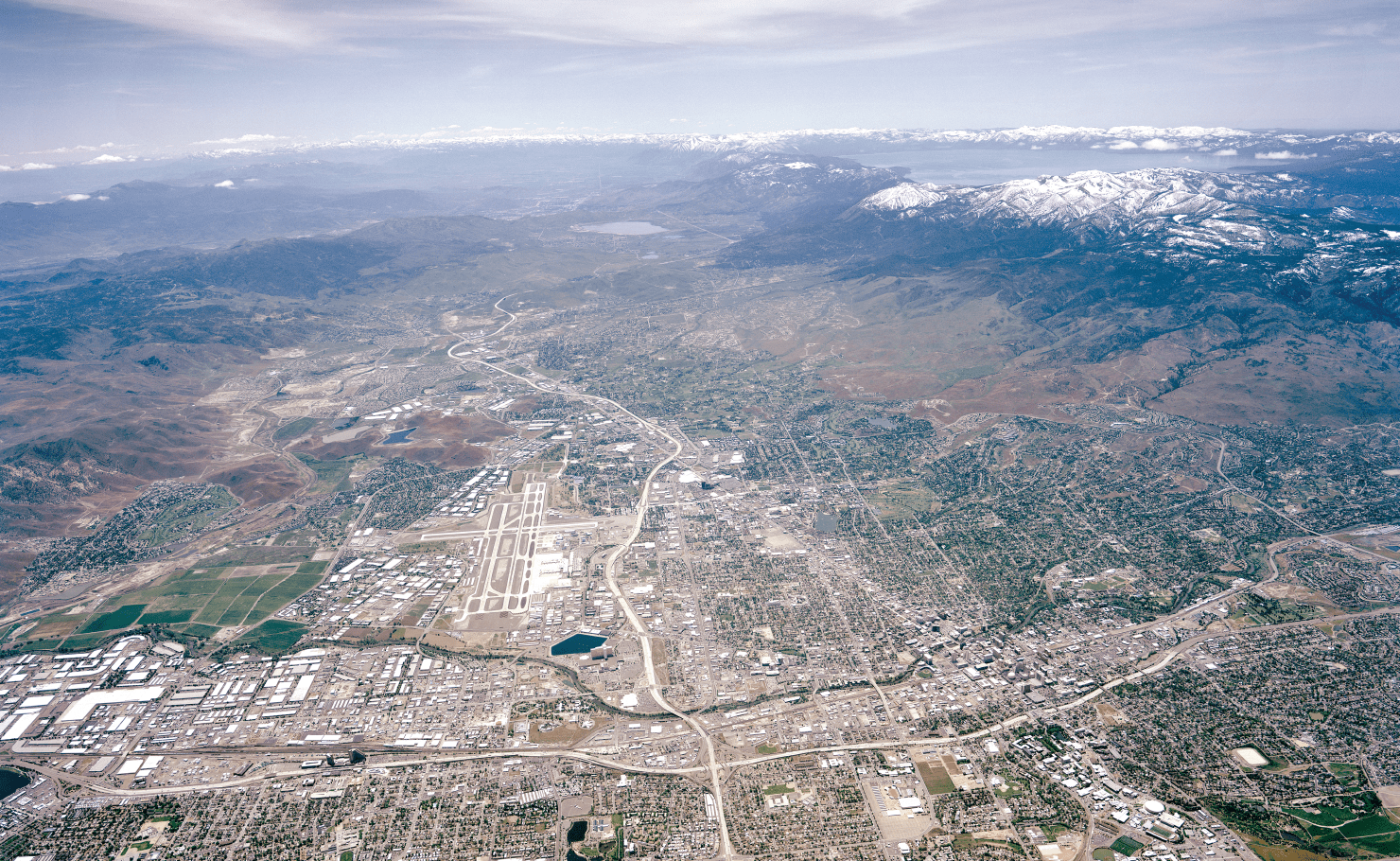
Oblique Aerial Imagery
Our oblique imagery captures comprehensive views of buildings, landscapes, and cityscapes with added depth and dimension that vertical photos cannot match. This service is particularly valuable for real estate marketing, urban planning, and landscape visualization.
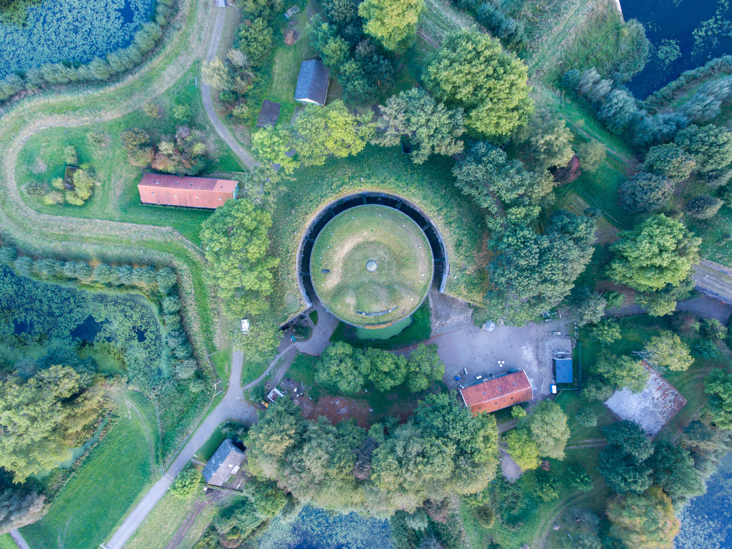
Enhanced Aerial Mapping with Oblique Images
Combining oblique and vertical imagery, we provide enhanced aerial mapping services that offer detailed surface visualization crucial for planning and development projects. This hybrid approach helps in detailed terrain analysis and project visualization.
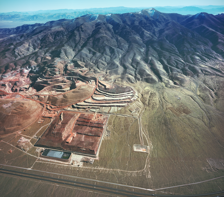

Aerial Imaging Services
We deliver high-quality, wide format aerial imaging suitable for a variety of applications, from documenting large-scale events to detailed environmental monitoring. Our services ensure you receive the most detailed and useful imagery available.
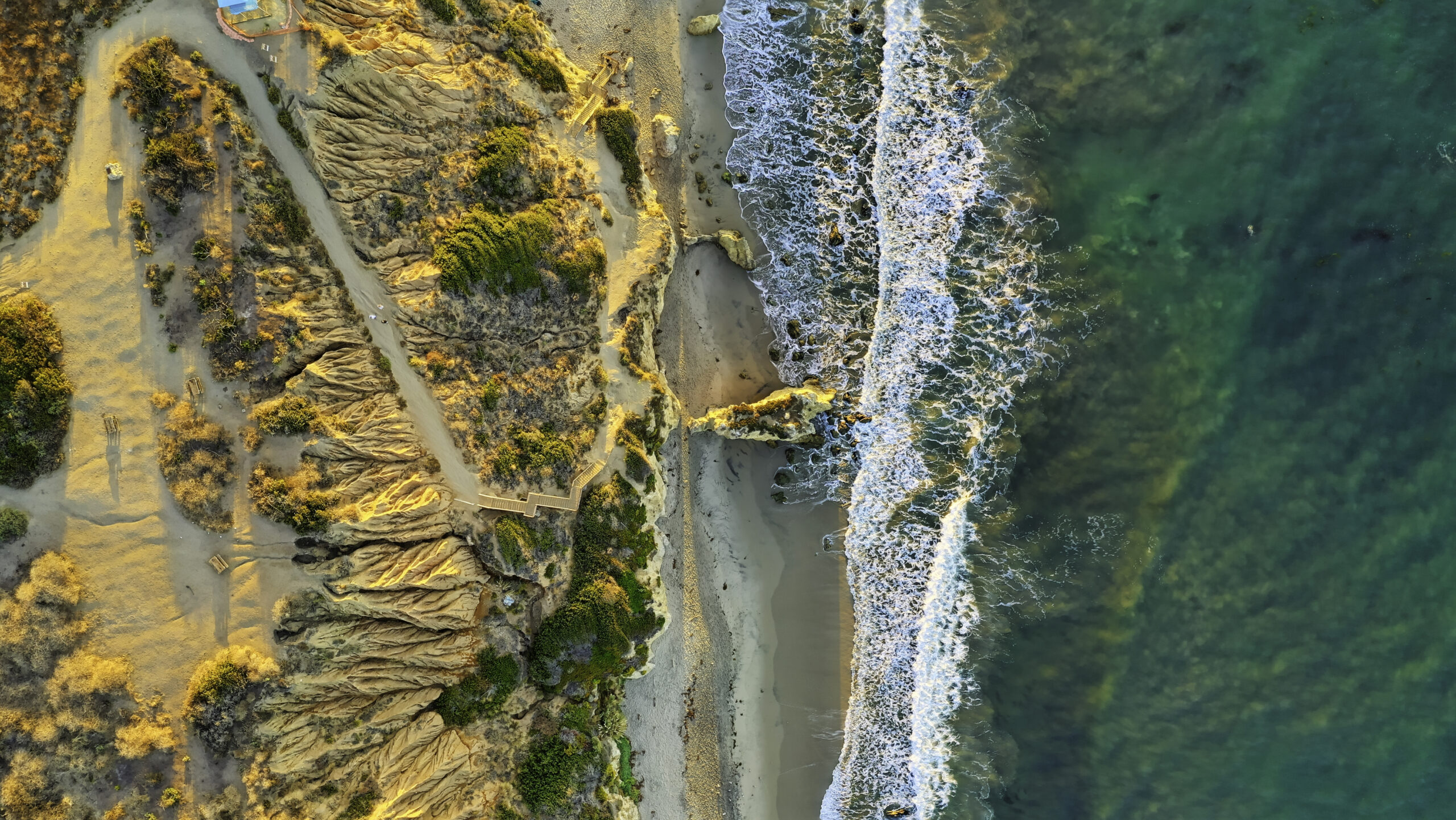
Oblique Photographs for Environmental and Urban Studies
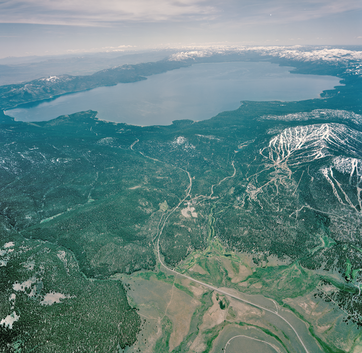
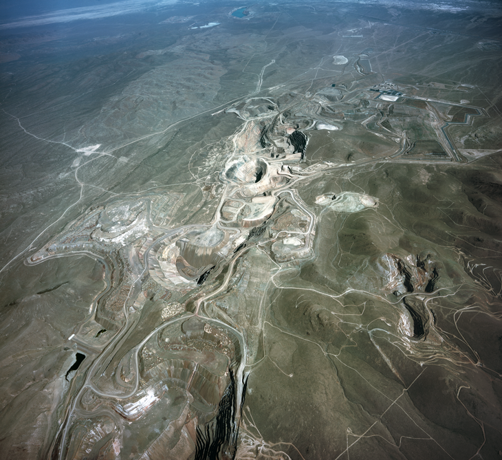
Our oblique photographs are a critical tool in environmental monitoring and urban development studies, providing angles that highlight changes in terrain, track developments, and aid in conservation efforts.
Vertical and Oblique Integration for Comprehensive Coverage
We integrate oblique imagery with traditional vertical aerial photos to offer a comprehensive view of surveyed areas, enhancing the overall utility of the aerial surveys for detailed analytical purposes.
Enhance Your Perspective with Oblique Imagery
Unlock new dimensions in your project visuals with Synergy Mapping’s expert Oblique Imagery services. Discover the impact of enhanced perspective on your planning and analysis.
Contact Synergy Mapping, Inc. for detailed, actionable aerial insights.Why Choose Synergy Mapping, Inc.?
At Synergy Mapping, Inc., we are recognized as leaders in delivering comprehensive oblique imagery services. Our unwavering commitment to excellence and precision in capturing unique aerial perspectives sets us apart in the industry, ensuring that every project we undertake is executed with the highest standards of detail and quality.

Advanced Equipment
We utilize the latest camera technology and aerial platforms, ensuring that each oblique image captured offers exceptional clarity and detailed insights. This cutting-edge technology allows us to capture intricate details that are crucial for thorough analysis and documentation.

Expertise in Aerial Imaging
Our team possesses extensive experience in oblique aerial photography, guaranteeing that each photograph meets the rigorous standards expected by our clients. This expertise ensures superior quality and actionable insights across all projects.

Customized Solutions
We carefully tailor our oblique imagery services to meet the specific demands of various industries, ensuring that each client receives precisely the data they need for their particular project. This bespoke service approach allows us to address the unique challenges and objectives of different sectors effectively.

Wide Geographic Coverage
Operating across Colorado, Nevada, California and the United States, our services are widely accessible, providing flexibility and convenience to a diverse client base. This extensive coverage ensures that we can deliver our high-quality oblique imagery services to a broad audience, regardless of their location.

Dedicated Customer Support
Our commitment to customer service is unmatched, providing continuous support from project planning through to final image delivery and beyond.
Real Results:
Hear What Our Clients Are Saying
Contact Synergy Mapping, Inc.
Dive deeper into the landscape with oblique imagery from Synergy Mapping, Inc. Reach out now for a consultation and discover how our aerial photography can transform your project planning and execution.
FAQs About Oblique Imagery
What is Oblique Imagery?
Oblique imagery refers to photographs taken from an angle rather than directly overhead, typically from aircraft. This type of imagery captures the sides of objects as well as the tops, offering a three-dimensional perspective.
What is Oblique Aerial Imagery?
Oblique aerial imagery is a form of photography where the camera is angled to capture the sides of buildings and landscapes, providing a more comprehensive view than vertical (top-down) imagery. It reveals more architectural and topographical details, enhancing visual understanding.
What are oblique aerial photographs used for?
Oblique aerial photographs are used in urban planning, real estate, environmental studies, and public safety. They are valuable for visualizing how new structures will fit into existing environments.
What are the benefits of oblique imagery?
The benefits of oblique imagery include improved visual context and enhanced depth perception. This type of imagery is excellent for analysis, presentation, and decision-making in complex spatial environments.
What angle is oblique imagery?
Oblique imagery is typically captured at angles between 20 to 45 degrees relative to the earth’s surface, providing a balance between surface detail and horizon visibility. This angle allows for the effective portrayal of both the landscape’s surface and its vertical features.
