Aerial Infrared Imagery Services
Are you searching for “Aerial Infrared Imagery Services Near Me?”’
Synergy Mapping, Inc. provides exceptional aerial infrared imagery services that cater to a diverse range of industries, including construction, urban development, and mining. Our high-resolution cameras capture detailed infrared data, essential for environmental monitoring and energy audits. Connect with us today to learn how our infrared imaging can provide critical insights for your projects.
Synergy Mapping, Inc., where aerial infrared imagery is tailored to meet industry-specific demands. We excel in providing high-definition infrared imaging solutions across various sectors, utilizing cutting-edge technology and expert professionals to guarantee precise and thorough coverage.

An Introduction to Synergy Mapping, Inc.
Welcome to Synergy Mapping, your premier provider of aerial infrared imagery services. We serve sectors ranging from land surveyors and construction firms to government agencies and environmental groups across Colorado, Nevada, California and the United States. At Synergy Mapping, we are committed to delivering precise, high-definition infrared imagery that meets the highest standards and advances the success of your projects. Let us help you uncover the unseen with our cutting-edge infrared technology.
Unlock the Hidden Details with Infrared Imaging
Discover what lies beneath with Synergy Mapping’s advanced infrared imaging services. Ideal for detecting environmental and structural variations invisible to the naked eye.
Contact Synergy Mapping, Inc. today —to learn how our infrared solutions can provide deeper insights into your projects.Our services cater to a range of industries
At Synergy Mapping, Inc., our aerial infrared imagery services are instrumental across a variety of sectors, providing essential data and insights to support a wide range of professional activities:
Engineering & Construction
Our high-resolution infrared imagery is invaluable for construction companies involved in large-scale projects. By revealing insulation weaknesses and other critical data, we assist in the planning, monitoring, and efficiency optimization of construction projects, ensuring resources are used effectively and timelines are met.
Architecture & Urban Planning
Urban planners and architects benefit from our detailed infrared imaging, which can detect heat patterns and energy efficiency in cityscapes and buildings. This data is crucial for the integration of energy-efficient practices in new developments and for retrofitting existing structures.
Environmental Conservation
Committed to aiding environmental conservation, our infrared imaging services are pivotal in monitoring ecosystems. They provide vital data for tracking wildlife, understanding vegetative health, and managing water bodies, offering valuable insights for conservation and ecological studies.
Infrastructure Development
Our services deliver precise data essential for the maintenance and development of infrastructure. Detailed infrared imagery helps in assessing the condition of roads, bridges, and public utilities, facilitating effective maintenance and safety checks.
Forestry & Natural Resources Management
In forestry, our infrared imagery supports sustainable management by monitoring plant health and detecting disease outbreaks. It is also used in managing natural resources, providing data on soil moisture and forest biomass.
Government
Governmental bodies utilize our infrared imaging for various purposes, such as emergency response planning, and energy management. Our reliable data supports informed decision-making and effective governance.
Our infrared imaging solutions underscore our role as a versatile and crucial service provider in the realm of geospatial analysis and surveying. At Synergy Mapping, we are dedicated to offering services that meet and exceed the diverse needs of our clientele.
Discover the Power of Infrared Imaging
Unlock the potential of aerial infrared imagery for your projects. Contact Synergy Mapping, Inc. today to see how our advanced solutions can make a difference
Contact Synergy Mapping, Inc.Benefits of Using Synergy Mapping, Inc.
Precision and Clarity: Our high-definition IR cameras are not just tools; they are extensions of our commitment to excellence. They capture every subtle temperature variation and heat pattern, providing imagery rich in detail that significantly enhances analytical capabilities for projects. This level of detail is essential for applications such as detecting structural defects in engineering, identifying moisture intrusion in buildings, or observing subtle ecological changes in environmental conservation.
Rapid Turnaround: Understanding the importance of time in project management, Synergy Mapping, Inc. has optimized its workflow to ensure quick deployment of our aerial teams and fast processing of high-quality infrared images. This rapid turnaround is critical for clients who rely on timely data to make informed decisions, manage risks, and maintain project schedules, all without compromising the integrity and quality of the imagery provided.
Industry-Specific Expertise: Each industry has its unique set of challenges and requirements, and at Synergy Mapping, Inc., we have developed our expertise to tailor our infrared imaging services accordingly. For the mining sector, we focus on surveying vast areas to identify mineral deposits or monitor changes. In construction, we assess the integrity of structures and insulation. Environmental monitoring benefits from our ability to track wildlife and assess vegetation health, providing actionable insights with each image.
Comprehensive Coverage: At Synergy Mapping, Inc., we pride ourselves on offering comprehensive infrared imaging services that encompass every phase of your project. From the initial consultation where we define your needs and project scope, through to the detailed planning and execution of imaging flights, and concluding with ongoing support and data analysis, we ensure a seamless service experience. Our goal is to be your infrared imaging partner throughout the lifecycle of your project.
Cost Efficiency: By leveraging state-of-the-art technology and maintaining efficient operational processes, we offer cost-effective solutions that do not compromise on quality. Our ability to provide high-quality infrared imagery at competitive prices means that our clients can invest more confidently in their projects, knowing that they are not only receiving data essential for their success but also managing their budgets effectively.
Our Aerial Infrared Imagery Services
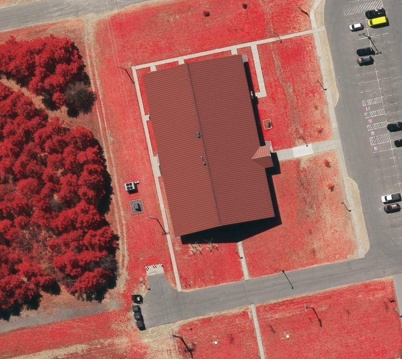
High-Resolution Infrared Imaging
Utilizing advanced cameras, our aerial infrared imaging service captures detailed data that is crucial for detecting energy loss, identifying insulation weaknesses in buildings, and monitoring large-scale industrial operations.
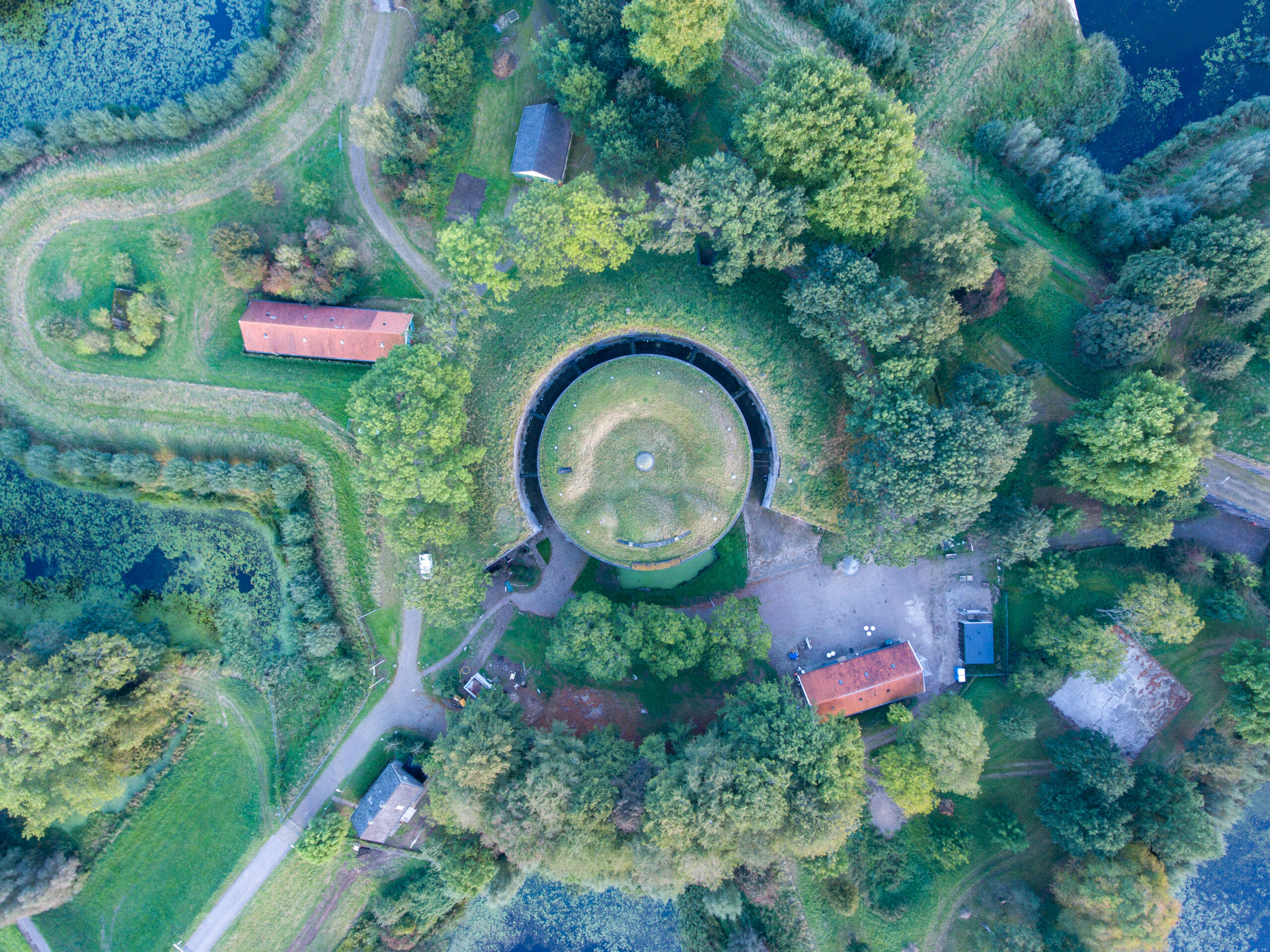
Land Surveying with Infrared Technology
Our aerial infrared imagery supports land surveyors by providing detailed maps that help in the analysis of soil moisture, vegetation health, and other environmental parameters critical for land development and agricultural planning.
Ready to Enhance Your Project with Infrared Imaging?
Elevate your project’s standards with our specialized aerial infrared imagery services. Explore your options with one of our experts today.
Get in touch with Synergy Mapping, Inc. for a personalized consultation.Why Choose Synergy Mapping, Inc.?
At Synergy Mapping, Inc., we stand out as the leader in providing comprehensive aerial infrared imagery services. Our commitment to excellence and precision in aerial infrared imaging sets us apart, ensuring that every project we undertake meets the highest standards of accuracy and quality.

Advanced Infrared Technology
We deploy the latest cameras, ensuring that every image captures detailed data necessary for your analysis.
Expertise in Infrared Analysis
Our team includes skilled imaging specialists with extensive experience in interpreting data, ensuring that you receive insightful and actionable information.

Customized Solutions
We understand that each project has unique requirements. Our services are tailored to meet the specific needs of different industries, from environmental conservation to urban development.

Extensive Coverage
With operations across Colorado, Nevada, California and the entire United States, we ensure comprehensive geographic service coverage, making our services accessible to a wide range of clients.

Dedicated Customer Support
Our commitment to customer satisfaction drives us to provide ongoing support throughout your project, from initial data capture to final analysis.
Real Results:
Hear What Our Clients Are Saying
Contact Synergy Mapping, Inc.
Step into the future of project analysis with Synergy Mapping, Inc.’s aerial infrared imagery services. Reach out now for a consultation, and let’s get started on transforming your project insights!
FAQs About Aerial Infrared Imagery
How is infrared imagery used?
Infrared imagery is used to capture data based on the infrared radiation emitted by objects. This type of imagery is invaluable in various fields such as agriculture for monitoring crop health, in construction for detecting heat leaks, in environmental science for studying wildlife habitats, and in security for surveillance activities.
What does infrared imagery show?
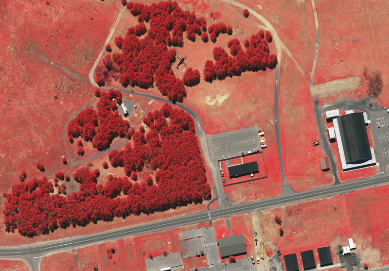
Infrared imagery shows the heat emitted by objects, allowing for the detection of properties that are not visible in standard visual imagery. This includes variations in heat across an area, which can indicate differences in materials, moisture content, and other physical properties.
What is color infrared imagery?
Color infrared imagery, often referred to as false-color imagery, uses a color spectrum to represent infrared data, making it easier to interpret and analyze. This type of imagery is particularly useful in distinguishing different materials and conditions in vegetation, water bodies, and urban settings based on how they emit or reflect infrared light.
What is infrared imagery?
Infrared imagery involves capturing images of objects based on the infrared radiation they emit. Unlike visible light, infrared light is not detectable by the human eye and requires special sensors to capture.
What does infrared imagery reveal?
Infrared imagery reveals differences in temperature and heat emissions from various objects and surfaces. It can uncover hidden defects in mechanical and electrical systems, detect water and heat leaks in buildings, and provide critical data for environmental monitoring and management.
